C-MAP Reveal Coastal Great Lakes to Nova Scotia
$288.60 Original price was: $288.60.$260.00Current price is: $260.00.
C-MAP Reveal Coastal Chesapeake Bay to the Bahamas
$288.60 Original price was: $288.60.$260.00Current price is: $260.00.
Fast delivery within 72 Hours
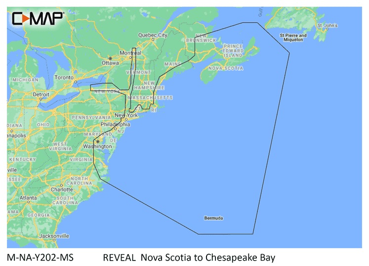
C-MAP Reveal Coastal Nova Scotia to Chesapeak Bay
$288.60 Original price was: $288.60.$260.00Current price is: $260.00.
10 in stock
SKU:
WT-CMAMNAY202MS
Category: C-MAP Precision
Brands:
C-Map
C-MAP Reveal M-NA-Y202-MS charts offer the best of C-MAP, featuring Shaded Relief, Full-Featured Vector Charts, and High-Res Bathy for unparalleled navigation. Ideal for outboard lower unit systems, get 12 months of free online updates.
Description
C-MAP M-NA-Y202-MS Reveal Coastal Nova Scotia to Chesapeak Bay
Model: M-NA-Y202-MS
- Shaded Relief — bring the world around you to life, with 3D rendered land and underwater elevation — including areas of Ultra-High-Res Bathy seafloor imagery, previously only available in MAX-N+ Reveal a game changer for anglers.
- Full-Featured Vector Charts — making navigation easy by giving you accurate, up-to-date vector chart detail derive from official Hydrographic Office information.
- High-Res Bathy — helps you identify shallow areas, drop-offs, ledges, holes or humps. Now includes compiled and quality-controlled Genesis® detail as part of singular HRB layer.
- Custom Depth Shading — set a clear safety depth, maintain a paper-like view or create your own custom shading.
- Dynamic Raster Charts — providing the traditional chart look and feel, coupled with easy access to all objects on the chart.
- Easy Routing™ — helps you automatically plot the shortest, safest route based on detailed chart data and your personalized vessel information.
- Aerial Photography — a collection of thousands of photos of marinas, harbors, inlets and other notable navigational features included to offer an additional level of detail.
- Satellite Overlay — satellite imagery gives information about the surroundings when you find yourself in an unfamiliar place.
- Tides & Currents — shows projections of water level and direction of tides to help plan your day out, cruising, angling or sailing.
- Detailed Marina Port Plans — docking in an unfamiliar port is no problem when you have precise layouts of thousands of marinas, including slip spaces, restricted areas and other valuable navigation information.
- Harbor & Approach Details — unprecedented level of detail. Approach any harbor and inlet with confidence. The perfect conclusion to a long voyage, sailing adventure or an exciting day of fishing.
- Online Updates — keep your chart up to date, with 12 months’ free online updates.
Cruising, fishing or sailing, C-MAP® REVEAL™ Coastal charts offer the very best of C-MAP. With Shaded Relief, including game-changing Reveal Seafloor Imagery, Aerial Photography, Satellite Overlay and Dynamic Raster Chart presentation added to the core C-MAP features found in DISCOVER™ — full-featured Vector Charts, with Custom Depth Shading, Tides & Currents and subscription-free Easy Routing™. It also includes the very best of C-MAP High-Res Bathy, including integrated Genesis® data. Purchase includes a full 12 months of free online updates. Compatible with Lowrance, Simrad & B&G Chartplotters.
Additional information
| Weight | 0.1 lbs |
|---|---|
| Google Part Number |
M-NA-Y202-MS |
| Google Product Category |
3391 |
Related Products
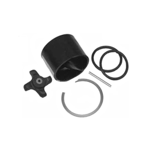
Airmar 33-493-01 Paddle Wheel Spares Kit For S800 ST800
SKU:
WT-AIR3349301
Airmar B164 1KW Bronze TH 12D Tilted Element 10P Furuno
SKU:
WT-AIRB1641210F
Airmar B164 1KW Bronze TH 20 Deg Tilt 8 Pin Garmin
SKU:
WT-AIRB164208G
Airmar B164 1KW Bronze TH 20D Tilted Element Raymarine
SKU:
WT-AIRB16420RAY
Airmar B175C-0-H 0d Tilt With Navico 7-Pin MM Cable
SKU:
WT-AIRB175C0HBL


