Garmin Striker 4 Reman Fishfinder GPS Track Plotter
Garmin Striker 4 Reman Fishfinder GPS Track Plotter Original price was: $137.99.Current price is: $123.59.
Back to products
ACR RCL300A HID Searchlight
ACR RCL300A HID Searchlight Original price was: $7,925.34.Current price is: $7,139.95.

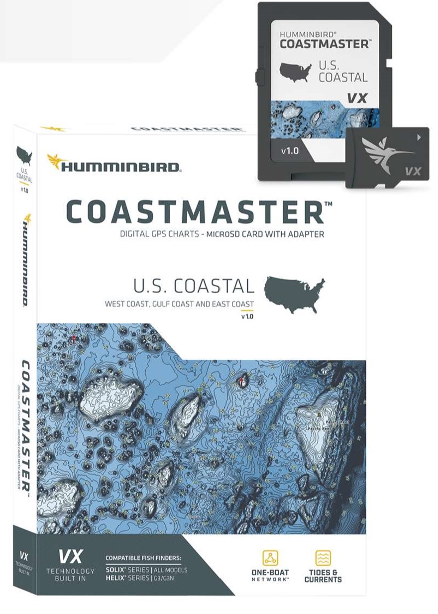
Humminbird CoastMaster US Coastal Chart v1

Original price was: $166.49.Current price is: $149.99.

Use the coupon codeĀ WELCOME5 at checkout to get 5% off on your first order

“Experience precise coastal navigation with Humminbird CoastMaster US Coastal Chart v1 – 601015-1. Enjoy VX Technology, customizable views, and predictive software for a successful fishing trip. Compatible with outboard lower unit, HELIX G3/G3N, and SOLIX units. Get accurate chart coverage for all US coastal waters.”

Out of stock

Description

the Humminbird CoastMaster US Coastal Chart v1:

Humminbird CoastMaster US Coastal Chart v1

The Humminbird CoastMaster US Coastal Chart v1 is a highly detailed and accurate chart that provides a comprehensive view of the US coastline. With its advanced technology and precise data, this chart is designed to help anglers, sailors, and boaters navigate the waters with confidence. The Humminbird CoastMaster US Coastal Chart v1 covers the entire US coastline, including Alaska and Hawaii, and features a range of valuable data, including buoys, beacons, and navigation aids.

One of the key benefits of the Humminbird CoastMaster US Coastal Chart v1 is its ability to provide fishermen with detailed information on fish habitats, structure, and other underwater features. This allows them to pinpoint the best fishing spots and increase their chances of catching the big one. The chart also includes information on water depth, water temperature, and other environmental factors that can affect fishing success.

In addition to its fishing applications, the Humminbird CoastMaster US Coastal Chart v1 is also an excellent tool for boaters and sailors. It provides detailed information on navigation channels, marinas, and other points of interest, making it easier to plan and execute a safe and enjoyable voyage. Whether you’re fishing, cruising, or simply exploring the coastline, the Humminbird CoastMaster US Coastal Chart v1 is an essential tool to have on board.

Why pick the Humminbird CoastMaster US Coastal Chart v1:

  • Highly detailed and accurate chart of the US coastline
  • Provides valuable data on fish habitats, structure, and other underwater features
  • Includes information on navigation channels, marinas, and other points of interest
  • Easy to use and integrate with your Humminbird fish finder or chart plotter

Where to use it:

The Humminbird CoastMaster US Coastal Chart v1 is designed for use in a variety of coastal and offshore applications, including:

  • Fishing: Identify the best fishing spots and increase your chances of catching the big one
  • Boating: Plan and execute a safe and enjoyable voyage with detailed information on navigation channels and points of interest
  • Sailing: Get accurate and up-to-date information on water depth, water temperature, and other environmental factors that can affect your journey

Tips for maintenance:

To get the most out of your Humminbird CoastMaster US Coastal Chart v1, follow these simple maintenance tips:

  • Regularly update your chart to ensure you have the latest data and information
  • Store your chart in a protective case to prevent damage from the elements
  • Use a high-quality chart plotter or fish finder to ensure accurate and reliable data
  • Consult the user manual for troubleshooting and maintenance tips

The Humminbird CoastMaster US Coastal Chart v1 is an essential tool for anyone who spends time on the water. With its advanced technology, precise data, and range of valuable features, it’s the perfect choice for anglers, sailors, and boaters. Whether you’re fishing, cruising, or simply exploring the coastline, the Humminbird CoastMaster US Coastal Chart v1 is an investment that will pay dividends for years to come.

Humminbird CoastMaster US Coastal Chart v1 is designed to provide accurate and reliable data, and with its advanced technology, it’s easy to use and integrate with your Humminbird fish finder or chart plotter. The Humminbird CoastMaster US Coastal Chart v1 is a must-have for anyone who wants to get the most out of their time on the water.

In conclusion, the Humminbird CoastMaster US Coastal Chart v1 is a highly detailed and accurate chart that provides a comprehensive view of the US coastline. With its range of valuable features and advanced technology, it’s the perfect choice for anglers, sailors, and boaters. Whether you’re fishing, cruising, or simply exploring the coastline, the Humminbird CoastMaster US Coastal Chart v1 is an essential tool to have on board.

Additional information
Weight 0.42 lbs
Brand

Brand

Humminbird

Reviews (0)
0 reviews
0
0
0
0
0

There are no reviews yet.

Only logged in customers who have purchased this product may leave a review.

Shipping & Delivery

Fast Delivery with FedEx

We understand that getting your products quickly is important. Our partnership with FedEx guarantees:

  • Speedy Shipping: Reliable, fast delivery to get your order to you in no time.
  • Real-Time Tracking: Stay updated with the status of your shipment every step of the way.

Secure Checkout Options

Weā€™ve made online shopping safe and simple by offering trusted payment options:

  • Credit Cards/Debit Cards: We accept all major credit cards & Debit Cards with encrypted, secure processing to protect your sensitive data.

RELATED PRODUCTS