C-MAP M-NA-D943 4D Local Florida And The Bahamas
The C-MAP M-NA-D943 4D Local Florida And The Bahamas is a high-performance electronic chart that provides detailed and accurate navigation data for Florida and the Bahamas. This chart is designed for use with chart plotters and navigation systems, and it offers a range of features and benefits that make it an ideal choice for boaters and fishermen.
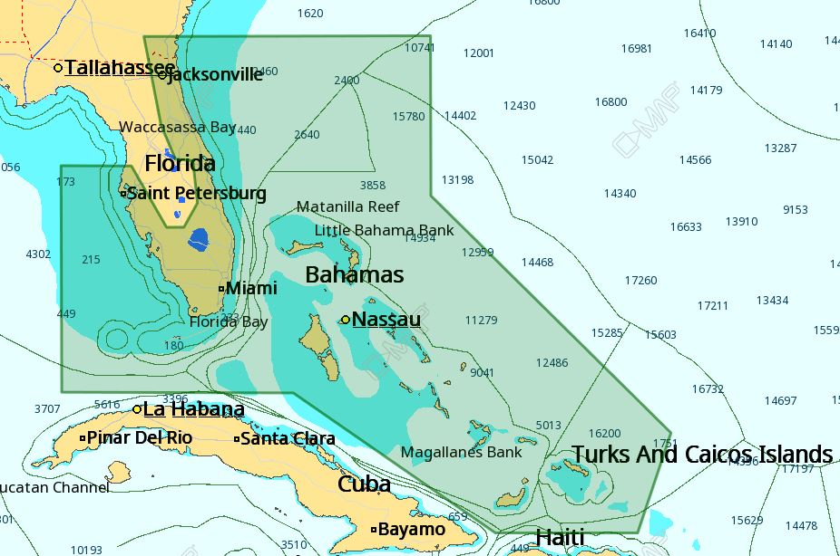
The C-MAP M-NA-D943 4D Local Florida And The Bahamas includes detailed shore-to-shore coverage of Florida, including the Keys, and the Bahamas, as well as coverage of the Gulf of Mexico and the Atlantic Ocean. This chart also includes 3D bathymetric data, which provides a detailed representation of the seafloor, allowing users to better understand the underwater environment.
In addition to its detailed coverage, the C-MAP M-NA-D943 4D Local Florida And The Bahamas also includes a range of features that enhance its usability and functionality. These features include dynamic tides and currents, which provide users with real-time information on sea conditions, and a range of customizable settings that allow users to tailor the chart to their specific needs.
The C-MAP M-NA-D943 4D Local Florida And The Bahamas is also compatible with a range of chart plotters and navigation systems, making it easy to integrate into existing systems. This chart is also regularly updated to ensure that it remains accurate and up-to-date, providing users with the most reliable and trustworthy navigation data available.
Why pick the C-MAP M-NA-D943 4D Local Florida And The Bahamas:
The C-MAP M-NA-D943 4D Local Florida And The Bahamas offers a range of unique benefits that make it an ideal choice for boaters and fishermen. These benefits include:
- Highly detailed and accurate navigation data
- 3D bathymetric data for a better understanding of the seafloor
- Dynamic tides and currents for real-time sea condition information
- Customizable settings for tailored functionality
Where to use it:
The C-MAP M-NA-D943 4D Local Florida And The Bahamas is designed for use in Florida and the Bahamas, making it an ideal choice for boaters and fishermen who operate in these areas. Specifically, this chart is suitable for use in:
- Florida, including the Keys
- The Bahamas
- The Gulf of Mexico
- The Atlantic Ocean
Tips for maintenance:
To ensure that the C-MAP M-NA-D943 4D Local Florida And The Bahamas remains accurate and up-to-date, it is essential to regularly update the chart. Additionally, users should:
- Regularly check for software updates
- Ensure that the chart is properly installed and configured
- Consult the user manual for guidance on using the chart effectively
The C-MAP M-NA-D943 4D Local Florida And The Bahamas is a high-performance electronic chart that provides detailed and accurate navigation data for Florida and the Bahamas. With its range of features and benefits, it is an ideal choice for boaters and fishermen who require reliable and trustworthy navigation data. By following the tips for maintenance, users can ensure that the chart remains accurate and up-to-date, providing them with the best possible navigation experience.










Reviews
Clear filtersThere are no reviews yet.