C-MAP NA-C313 Muscongus Bay To Cape May Bathymetric
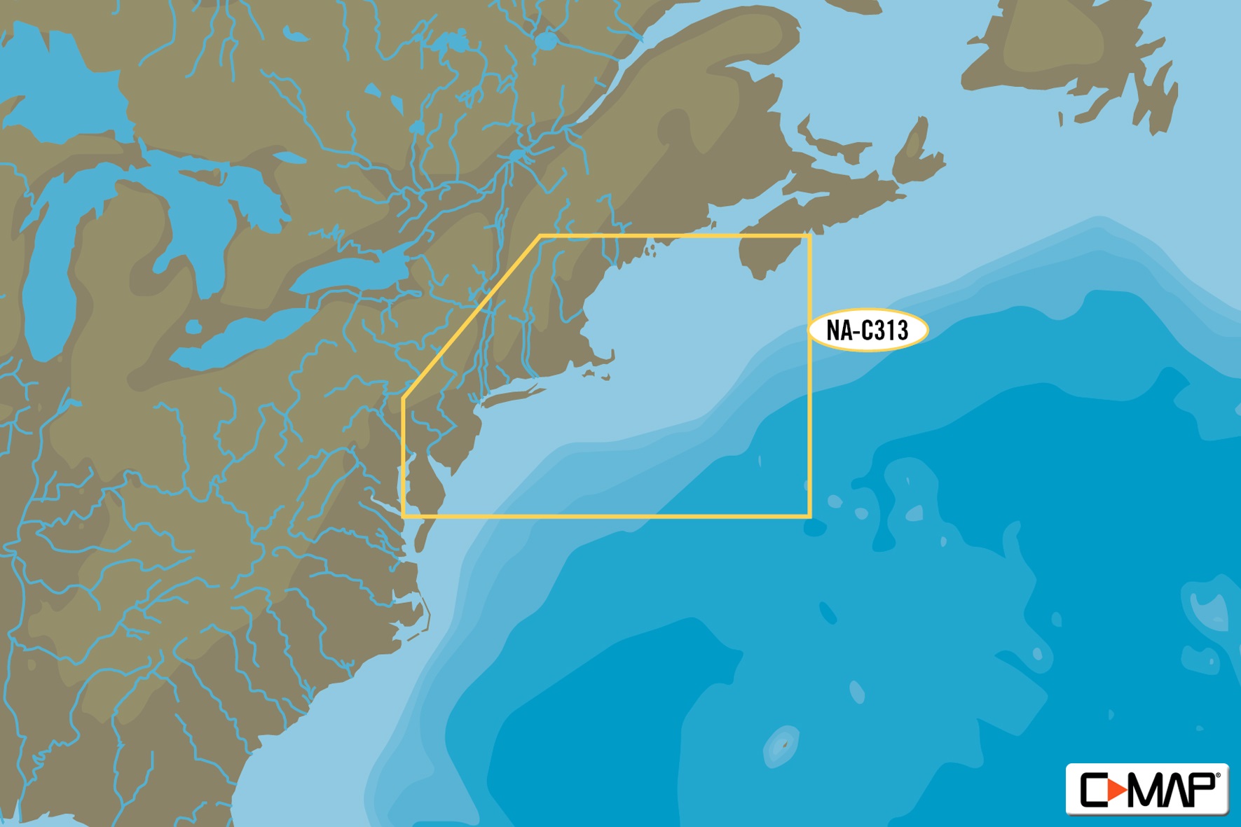
The C-MAP NA-C313 Muscongus Bay To Cape May Bathymetric chart provides detailed coverage of the Muscongus Bay to Cape May area, including the coast of Maine and New Jersey. This chart features C-MAP’s patented bathymetric data, providing a detailed representation of the seafloor. The chart also includes detailed harbor charts, allowing you to navigate with confidence. With C-MAP’s advanced chart technology, you’ll have access to a range of valuable features, including tidal information, depth contours, and underwater obstructions.
The C-MAP NA-C313 Muscongus Bay To Cape May Bathymetric chart is perfect for fishermen, sailors, and cruisers who need to navigate the waters of Maine and New Jersey. Whether you’re fishing for striped bass or sailing to Cape May, this chart provides the detailed information you need to get where you’re going safely and efficiently. The C-MAP NA-C313 Muscongus Bay To Cape May Bathymetric chart is compatible with a range of chart plotters and navigation systems, making it easy to integrate into your existing setup.
Why pick the C-MAP NA-C313 Muscongus Bay To Cape May Bathymetric?
The C-MAP NA-C313 Muscongus Bay To Cape May Bathymetric chart offers a range of benefits that make it an essential tool for anyone navigating the waters of Maine and New Jersey. With its detailed bathymetric data, you’ll have a clear understanding of the seafloor, allowing you to avoid underwater obstructions and navigate with confidence. Additionally, the chart’s advanced chart technology provides a range of valuable features, including tidal information and depth contours.
Where to use it
The C-MAP NA-C313 Muscongus Bay To Cape May Bathymetric chart is perfect for use in a range of applications, including:
- Fishing: With its detailed bathymetric data, the C-MAP NA-C313 Muscongus Bay To Cape May Bathymetric chart is ideal for fishermen who need to navigate the waters of Maine and New Jersey.
- Sailing: Whether you’re sailing to Cape May or exploring the coast of Maine, this chart provides the detailed information you need to get where you’re going safely and efficiently.
- Cruising: The C-MAP NA-C313 Muscongus Bay To Cape May Bathymetric chart is perfect for cruisers who need to navigate the waters of Maine and New Jersey.
Tips for maintenance
To get the most out of your C-MAP NA-C313 Muscongus Bay To Cape May Bathymetric chart, be sure to:
- Regularly update your chart to ensure you have access to the latest data and features.
- Use a high-quality chart plotter or navigation system to ensure accurate and reliable navigation.
- Keep your chart clean and dry to prevent damage and ensure optimal performance.














Reviews
Clear filtersThere are no reviews yet.