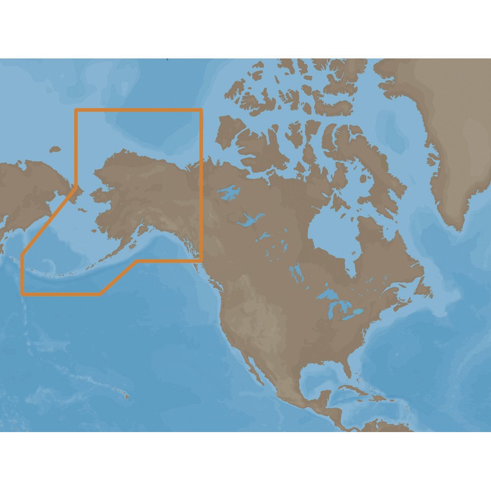
the C-MAP NA-M028 Max Wide C Card Alaska:
C-MAP NA-M028 Max Wide C Card Alaska
The C-MAP NA-M028 Max Wide C Card Alaska is a powerful and reliable chart plotter card that provides detailed and accurate navigation data for the coastal waters of Alaska. With its comprehensive coverage of the region, this card is an essential tool for any mariner or angler looking to explore the vast and unforgiving waters of Alaska.
The C-MAP NA-M028 Max Wide C Card Alaska features a vast array of navigation data, including charts, harbors, and ports, as well as detailed information on water depths, tides, and currents. This data is presented in a clear and easy-to-use format, making it simple to navigate even the most complex waterways. The card also includes a range of additional features, such as aerial photos, fishing charts, and 3D views, which provide valuable insights and help to enhance your overall navigation experience.
Whether you’re a seasoned mariner or just starting out, the C-MAP NA-M028 Max Wide C Card Alaska is the perfect tool for anyone looking to explore the waters of Alaska. With its comprehensive coverage and detailed navigation data, this card is an essential addition to any chart plotter system.
Why pick the C-MAP NA-M028 Max Wide C Card Alaska?
The C-MAP NA-M028 Max Wide C Card Alaska offers a range of unique benefits that make it the perfect choice for any mariner or angler. Some of the key advantages of this card include:
- Comprehensive coverage of the coastal waters of Alaska, providing detailed navigation data and insights.
- Easy-to-use format, making it simple to navigate even the most complex waterways.
- Additional features such as aerial photos, fishing charts, and 3D views, which provide valuable insights and enhance the overall navigation experience.
Where to use it
The C-MAP NA-M028 Max Wide C Card Alaska is perfect for use in a range of applications, including:
- Recreational boating and fishing, providing detailed navigation data and insights to help you find the best fishing spots.
- Commercial fishing, offering comprehensive coverage of the coastal waters of Alaska and helping you to navigate safely and efficiently.
- Cruising and sailing, providing detailed information on water depths, tides, and currents to help you navigate the waters of Alaska with confidence.
Tips for maintenance
To ensure that your C-MAP NA-M028 Max Wide C Card Alaska continues to function at its best, follow these simple maintenance tips:
- Regularly update your chart plotter software to ensure that you have access to the latest navigation data and features.
- Keep your chart plotter clean and free from dust and debris, to ensure that the card can read properly.
- Store your C-MAP NA-M028 Max Wide C Card Alaska in a safe and secure location, away from direct sunlight and extreme temperatures.


Reviews
Clear filtersThere are no reviews yet.