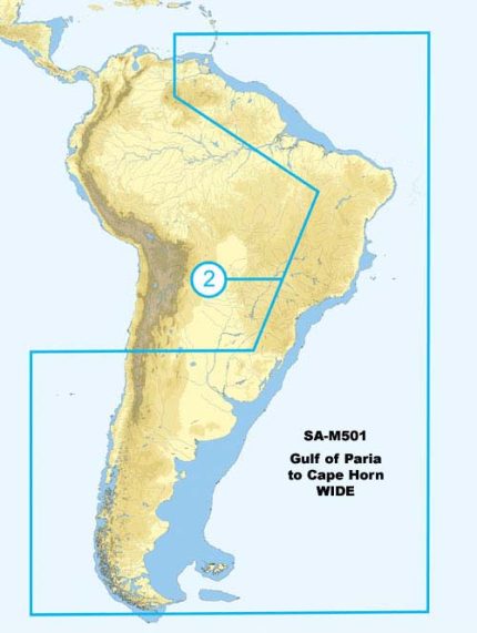
C-MAP SA-M500 Max Wide SD Costa Rica – Chile – Falklands
The C-MAP SA-M500 Max Wide SD Costa Rica – Chile – Falklands is a high-performance chart card that provides detailed and accurate navigation data for mariners. This chart card is designed to work seamlessly with a range of chart plotters and multifunction displays, offering a wide range of features and benefits that make it an ideal choice for navigators. The C-MAP SA-M500 Max Wide SD Costa Rica – Chile – Falklands is a reliable and trustworthy navigation solution that provides users with the confidence to navigate even the most challenging waters.
With the C-MAP SA-M500 Max Wide SD Costa Rica – Chile – Falklands, users can access a wide range of features, including detailed charts, tides and currents, and aerial photography. The chart card also includes a range of safety features, such as automatic routing and anti-grounding alerts, that help to ensure safe and successful navigation. The C-MAP SA-M500 Max Wide SD Costa Rica – Chile – Falklands is a powerful tool that is designed to help mariners navigate with confidence and precision.
Why pick the C-MAP SA-M500 Max Wide SD Costa Rica – Chile – Falklands:
The C-MAP SA-M500 Max Wide SD Costa Rica – Chile – Falklands offers a range of unique benefits that make it an ideal choice for mariners. Firstly, the chart card provides detailed and accurate navigation data, ensuring that users can navigate with confidence and precision. Secondly, the C-MAP SA-M500 Max Wide SD Costa Rica – Chile – Falklands is compatible with a range of chart plotters and multifunction displays, making it a versatile and convenient navigation solution. Finally, the chart card is designed to be easy to use, with a user-friendly interface that makes it simple to access and navigate the features and benefits on offer.
Where to use it:
The C-MAP SA-M500 Max Wide SD Costa Rica – Chile – Falklands is designed for use in a range of marine applications, including recreational boating, commercial fishing, and sailing. The chart card is particularly useful for mariners who need to navigate in coastal waters, as it provides detailed and accurate data on tides, currents, and other important navigation factors. Additionally, the C-MAP SA-M500 Max Wide SD Costa Rica – Chile – Falklands is a valuable tool for mariners who need to navigate in areas with limited visibility, such as in fog or at night.
Tips for maintenance:
To get the most out of the C-MAP SA-M500 Max Wide SD Costa Rica – Chile – Falklands, it is important to regularly update the chart card to ensure that the navigation data remains accurate and up-to-date. Additionally, users should regularly inspect the chart card for any signs of damage or wear, and replace it if necessary. Finally, users should always follow the manufacturer’s instructions for use and maintenance to ensure that the chart card functions correctly and safely.
In conclusion, the C-MAP SA-M500 Max Wide SD Costa Rica – Chile – Falklands is a high-performance chart card that provides detailed and accurate navigation data for mariners. With its range of features and benefits, the C-MAP SA-M500 Max Wide SD Costa Rica – Chile – Falklands is an ideal choice for mariners who need to navigate with confidence and precision. Whether you are a recreational boater, commercial fisherman, or sailor, the C-MAP SA-M500 Max Wide SD Costa Rica – Chile – Falklands is a valuable tool that can help you navigate even the most challenging waters.
The C-MAP SA-M500 Max Wide SD Costa Rica – Chile – Falklands is a


Reviews
Clear filtersThere are no reviews yet.