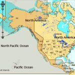
C-MAP NA-M035 Max MegaWide microSD Pacific Coast and Central America
$391.83 Original price was: $391.83.$353.00Current price is: $353.00.
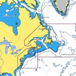
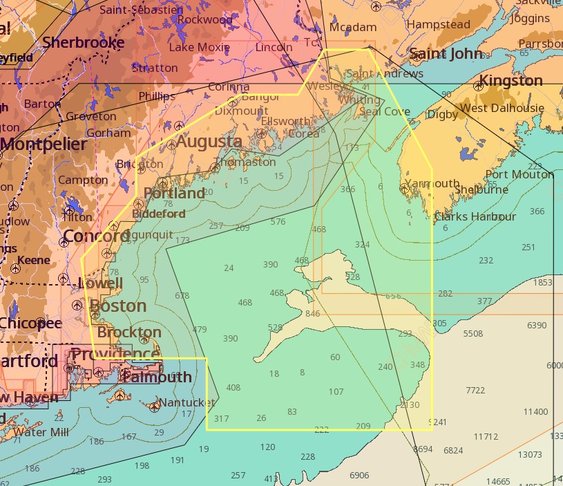
C-MAP NA-M325 Max Wide microSD Gulf of Maine Bathymetric
$309.69 Original price was: $309.69.$279.00Current price is: $279.00.
Fast delivery within 72 Hours
C-MAP NA-M325 Max Wide C-Card Gulf of Maine Bathymetric
$309.69 Original price was: $309.69.$279.00Current price is: $279.00.
Out of stock
SKU:
WT-CMAMNAM325CC
Category: C-MAP Max
“Explore the Gulf of Maine with C-MAP NA-M325 M-NA-M325-CC, featuring bathymetric charts, dynamic nav aids, tides & currents, and more. Perfect for outboard lower unit navigation, this chart provides detailed marina port plans and route-check for a safe boating experience.”
Description
C-MAP NA-M325 Max Wide C-Card Gulf of Maine Bathymetric
The C-MAP NA-M325 Max Wide C-Card Gulf of Maine Bathymetric is a premium chart card designed for boaters and fishermen who demand the best. This chart card provides detailed bathymetric data, including contours, depth soundings, and underwater features, allowing you to navigate the Gulf of Maine with confidence. The C-MAP NA-M325 Max Wide C-Card Gulf of Maine Bathymetric is compatible with a range of chart plotters and multifunction displays from leading brands.
With the C-MAP NA-M325 Max Wide C-Card Gulf of Maine Bathymetric, you’ll have access to a wealth of information, including coastal features, buoys, beacons, and other AIDS to navigation. The chart card also includes high-resolution satellite imagery, providing a clear visual representation of the seafloor and surrounding landscape. Whether you’re fishing, cruising, or simply exploring the Gulf of Maine, the C-MAP NA-M325 Max Wide C-Card Gulf of Maine Bathymetric is an essential tool for any serious boater.
Why pick the C-MAP NA-M325 Max Wide C-Card Gulf of Maine Bathymetric?
The C-MAP NA-M325 Max Wide C-Card Gulf of Maine Bathymetric offers several key benefits, including:
- Unparalleled detail and accuracy, ensuring you have the most up-to-date information at your fingertips.
- Seamless integration with a range of chart plotters and multifunction displays.
- High-resolution satellite imagery providing a clear visual representation of the seafloor and surrounding landscape.
Where to use it
The C-MAP NA-M325 Max Wide C-Card Gulf of Maine Bathymetric is perfect for boaters and fishermen operating in the Gulf of Maine, including:
- Fishing charters and commercial fishing vessels.
- Recreational boaters and cruisers.
- Marine researchers and scientists.
Tips for maintenance
To ensure your C-MAP NA-M325 Max Wide C-Card Gulf of Maine Bathymetric remains in optimal condition, follow these simple tips:
- Regularly update your chart card to ensure you have access to the latest data and features.
- Handle the chart card with care to avoid damage or corruption.
- Store the chart card in a protective case when not in use.
By choosing the C-MAP NA-M325 Max Wide C-Card Gulf of Maine Bathymetric, you’re investing in a premium navigation solution that will enhance your boating experience and provide unparalleled peace of mind. With its detailed bathymetric data, high-resolution satellite imagery, and seamless integration with leading chart plotters and multifunction displays, the C-MAP NA-M325 Max Wide C-Card Gulf of Maine Bathymetric is the perfect choice for serious boaters and fishermen operating in the Gulf of Maine.
Additional information
| Weight | 0.176 lbs |
|---|
Related Products
Airmar B164 1KW Bronze TH 12D Tilted Element 10P Furuno
SKU:
WT-AIRB1641210F
Airmar B164 1KW Bronze TH 20D Tilted Element Lowrance
SKU:
WT-AIRB16420BL
Airmar B175C-0-H 0d Tilt High CHIRP With MM Connector
SKU:
WT-AIRB175C0HMM
Airmar B175C-0-H 0d Tilt w/ Humminbird 14-Pin MM Cabl
SKU:
WT-AIRB175C0H14HB
Airmar B175C-0-H 0d Tilt With Navico 9-Pin MM Cable
SKU:
WT-AIRB175C0H9N
Airmar B175C-0-M 0d Tilt With No Connector MM Cable
SKU:
WT-AIRB175C0M0


