C-MAP NA-C045 Black Warrior & Lower Tom Bigbee River
$276.39 Original price was: $276.39.$249.00Current price is: $249.00.
C-MAP NA-C306 Bahamas
$276.39 Original price was: $276.39.$249.00Current price is: $249.00.
Fast delivery within 72 Hours
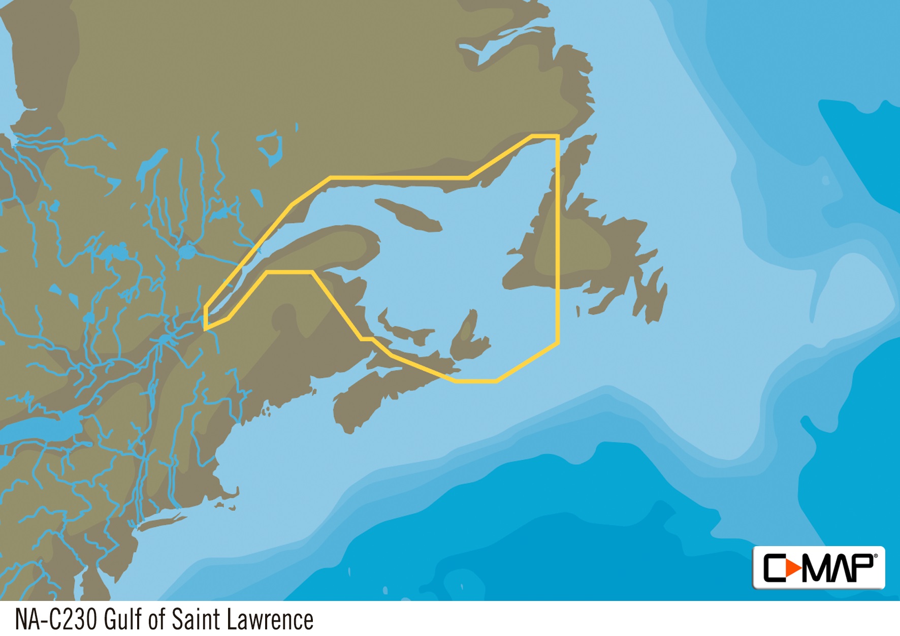
C-MAP NA-C230 Gulf Of St. Lawrence
$276.39 Original price was: $276.39.$249.00Current price is: $249.00.
Out of stock
SKU:
WT-CMANAC230CCARD
Category: C-MAP Max
“C-MAP NA-C230 Gulf of St. Lawrence nan offers accurate electronic charts for your outboard lower unit, providing detailed navigation data for safe and efficient boating. Get precise marine mapping and navigation solutions with this reliable chart plotter.”
Description
the C-MAP NA-C230 Gulf Of St. Lawrence:
C-MAP NA-C230 Gulf Of St. Lawrence
The C-MAP NA-C230 Gulf Of St. Lawrence is a comprehensive electronic chart that covers the Gulf of St. Lawrence, including the coasts of Quebec and Newfoundland, as well as the islands of Newfoundland and Prince Edward Island. This chart provides detailed information on water depths, buoys, beacons, and other navigational aids, making it an essential tool for mariners and fishermen operating in this region. With the C-MAP NA-C230 Gulf Of St. Lawrence, you can navigate with confidence, knowing that you have access to the most up-to-date and accurate data available.
The C-MAP NA-C230 Gulf Of St. Lawrence is part of the C-MAP NT+ series, which offers superior coverage and detail compared to traditional paper charts. This chart is compatible with a wide range of GPS plotters and fish finders, making it easy to integrate into your existing navigation system. Whether you’re a commercial fisherman, recreational boater, or simply a sailor, the C-MAP NA-C230 Gulf Of St. Lawrence is an invaluable resource that will help you navigate the waters of the Gulf of St. Lawrence with ease.
In addition to its comprehensive coverage, the C-MAP NA-C230 Gulf Of St. Lawrence also provides a range of valuable features, including detailed harbor charts, tides and currents, and fishing charts. This chart is updated regularly to ensure that it reflects the latest changes to the marine environment, providing you with the most accurate and up-to-date information available.
Why pick the C-MAP NA-C230 Gulf Of St. Lawrence:
- Provides comprehensive coverage of the Gulf of St. Lawrence, including the coasts of Quebec and Newfoundland, and the islands of Newfoundland and Prince Edward Island.
- Offers superior detail and accuracy compared to traditional paper charts.
- Compatible with a wide range of GPS plotters and fish finders.
- Updated regularly to ensure the most accurate and up-to-date information available.
Where to use it:
The C-MAP NA-C230 Gulf Of St. Lawrence is ideal for mariners and fishermen operating in the Gulf of St. Lawrence, including:
- Commercial fishermen and charter boat operators.
- Recreational boaters and sailors.
- Fishing guides and tour operators.
- Anyone navigating the waters of the Gulf of St. Lawrence.
Tips for maintenance:
To get the most out of your C-MAP NA-C230 Gulf Of St. Lawrence, be sure to:
- Regularly update your chart to ensure you have the latest information.
- Use your chart in conjunction with other navigation tools, such as GPS and radar.
- Keep your chart clean and dry to prevent damage.
- Store your chart in a safe place when not in use.
By following these guidelines, you can ensure that your C-MAP NA-C230 Gulf Of St. Lawrence remains a valuable resource for years to come.
Additional information
| Weight | 0.1 lbs |
|---|
Related Products
Airmar B164 1KW Bronze TH 0 Deg Tilt 8 Pin Garmin
SKU:
WT-AIRB16408G
Airmar B164 1KW Bronze TH 20D Tilted Element Raymarine
SKU:
WT-AIRB16420RAY
Airmar B175C-0-H 0d Tilt High CHIRP With MM Connector
SKU:
WT-AIRB175C0HMM
Airmar B175C-0-H 0d Tilt With Garmin 12-Pin MM Cable
SKU:
WT-AIRB175C0H12G
Airmar B175C-0-H 0d Tilt With Garmin 8-Pin MM Cable
SKU:
WT-AIRB175C0H8G
Airmar B175C-0-H 0d Tilt With Navico 9-Pin MM Cable
SKU:
WT-AIRB175C0H9N
Airmar B175C-0-M 0d Tilt With No Connector MM Cable
SKU:
WT-AIRB175C0M0


