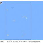
C-MAP Reveal Coastal Hawaii, Marshall Islands and French Polynesia
$288.60 Original price was: $288.60.$260.00Current price is: $260.00.
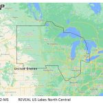
C-MAP Reveal Inland US Lakes North Central
$198.69 Original price was: $198.69.$179.00Current price is: $179.00.
Fast delivery within 72 Hours
C-MAP Reveal Inland US Lakes West
$198.69 Original price was: $198.69.$179.00Current price is: $179.00.
1 in stock
SKU:
WT-CMAMNAY211MS
Category: C-MAP Precision
Brands:
C-Map
Explore the C-MAP Reveal Inland US Lakes West M-NA-Y211-MS, featuring shaded relief, high-res bathymetry, and custom depth shading for optimized outboard lower unit performance. Get accurate routing, tides, and currents for a safer boating experience.
Description
C-MAP Reveal Inland US Lakes West
Model: M-NA-Y211-MS
- Shaded Relief
- Full-Featured Vector Charts
- High-Res Bathymetry
- Custom Depth Shading
- Dynamic Raster Charts
- Easy Routing
- Aerial Photos
- Satellite Overlay
- Tides & Currents
- Detailed Marina Port Plans
- Harbor & Approach Details
- Online Updates — including 12 months’ free online updates
- Compatible with Lowrance®, Simrad® & B&G® chartplotters
C-MAP® REVEAL charts display the very best of C-MAP. With Shaded Relief, including game-changing Ultra-High-Res Seafloor Imagery unique to REVEAL, Aerial Photography, Satellite Overlay and Dynamic Raster Chart presentation added to the core C-MAP features found in DISCOVER™
Vector charts, including Depth, Contour, Spot Soundings, NavAids, Light Sectors, Wrecks/Obstructions and more
Display the highest level of information, setting clear safety depths and identifying underwater pinnacles, ledges and canyons, magnets for coastal game fish
High resolution detail of nearshore & offshore features such as pinnacles, canyons and ledges helping anglers, includes Genesis® data
Automatically plots the shortest, safest route based on detailed chart and vessel information. Takes two points and generates a suggested route
Displays the time, water level and direction of tides with Tide Level graphs and indicates predicted current time, direction and strength. Flow graphs and coloured arrows
Raster charts bring a traditional paper chart look and feel
Shaded Relief presents the data with a 3D appearance, which is easier to interpret versus traditional contour lines
Satellite imagery provides realworld reference, enhances situational awareness for coastal navigation
Specifications
| Full-Featured Vector Charts | Yes |
| High-Resolution Bathymetry | Yes |
| Custom Depth Shading | Yes |
| Subscription-Free Easy Routing™ | Yes |
| Tides & Currents | Yes |
| Detailed Marina Port Plans | Yes |
| Multilanguage | Yes |
| Marine Protected Areas* | Yes |
| 12 Month’s Free Online Updates | Yes |
| Raster Charts | Yes |
| Aerial Photos* | Yes |
| Satellite Imagery* | Yes |
| Shaded Relief – Standard | Yes |
| Shaded Relief – Standard | Yes |
| * Select Areas | |
Additional information
| Weight | 0.1 lbs |
|---|---|
| Google Part Number |
M-NA-Y211-MS |
| Google Product Category |
3391 |
Related Products
Airmar B175C-0-H 0d Tilt High CHIRP With MM Connector
SKU:
WT-AIRB175C0HMM
Airmar B175C-0-H 0d Tilt w/ Humminbird 14-Pin MM Cabl
SKU:
WT-AIRB175C0H14HB
Airmar B175C-0-H 0d Tilt With Garmin 12-Pin MM Cable
SKU:
WT-AIRB175C0H12G
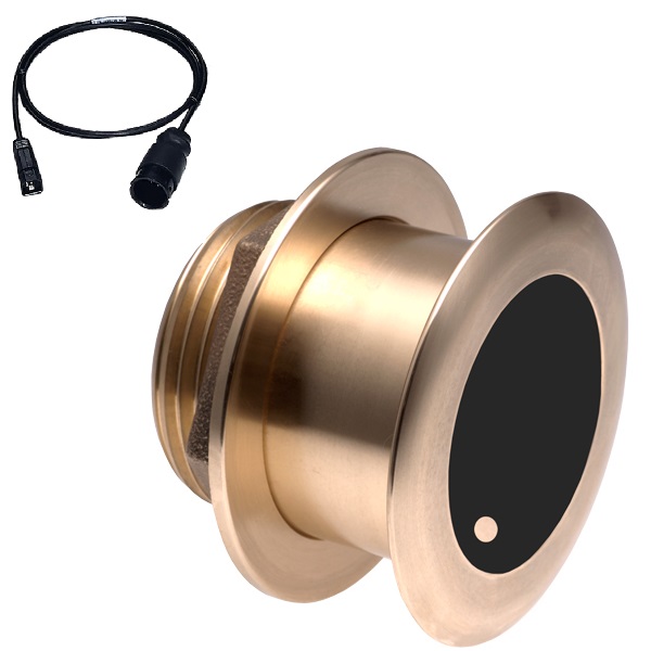
Airmar B175C-0-H 0d Tilt With Humminbird 7-Pin MM Cabl
SKU:
WT-AIRB175C0HHB
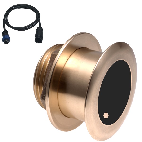
Airmar B175C-0-H 0d Tilt With Navico 7-Pin MM Cable
SKU:
WT-AIRB175C0HBL
Airmar B175C-0-H 0d Tilt With No Connector MM Cable
SKU:
WT-AIRB175C0H0
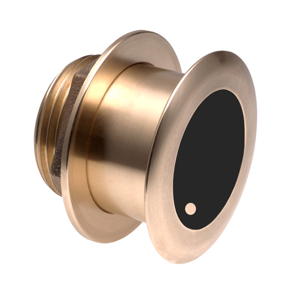
Airmar B175C-0-M 0d Tilt With No Connector MM Cable
SKU:
WT-AIRB175C0M0


