C-MAP Reveal X Canada microSD Best & Worst Features
C-MAP Reveal X Coastal Canada North and East microSD for Boats & Marine Engines
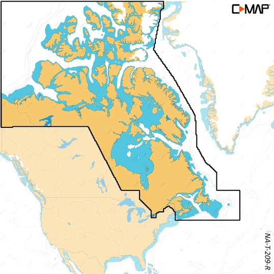
Introduction
The C-MAP Reveal X Coastal Canada North and East microSD is an advanced marine cartography solution tailored for boaters navigating Canada’s challenging northern and eastern coastlines. Known for its rugged waters, remote fishing grounds, and countless islands, this region demands precise and reliable navigation tools. This microSD card offers state-of-the-art mapping with 3D relief, detailed bathymetry, and satellite imagery to ensure your journey is both safe and efficient.
Perfectly designed for use with boats and marine engines, it provides real-time data, easy integration with modern chartplotters, and regular updates to keep you ahead of unexpected conditions. For sailors, fishermen, and commercial operators, this charting system is a must-have for confident navigation.
Overview / What Is C-MAP Reveal X Canada microSD
The C-MAP Reveal X Coastal Canada North and East microSD is a digital navigation card featuring high-definition charts of Canada’s northern and eastern waters. It delivers enhanced data for safe boating, including realistic 3D shaded relief, satellite overlays, dynamic raster charts, and up-to-date tidal information. The Reveal X technology elevates traditional navigation by merging precise bathymetric details with user-friendly interface controls.
This solution integrates with top chartplotter brands like Simrad, Lowrance, and B&G, making it an easy upgrade for any modern marine setup. Whether you’re cruising the Labrador coast or fishing off Newfoundland, this tool enhances your navigation experience by providing crucial underwater and coastline details.
Key Features of C-MAP Reveal X Canada North and East microSD
- 3D Shaded Relief: Realistic visualization of the seafloor for better hazard identification.
- High-Resolution Satellite Imagery: Provides clear coastal references for improved situational awareness.
- Dynamic Raster Charts: A blend of traditional and modern chart views for every navigation preference.
- Seamless Compatibility: Works with major chartplotter systems.
- Frequent Updates: Stay current with the latest navigational data.
Why Use C-MAP Reveal X Canada North and East for Navigation?
Navigating Canada’s north and east coasts can be difficult due to unpredictable weather, numerous islands, and hidden underwater hazards. This product ensures that you have the most reliable data at your fingertips, reducing risks and improving your ability to plan safe and efficient routes.
Unlike generic charts, this microSD offers superior detail and regular updates. For commercial users, it’s a valuable asset for reducing downtime and increasing operational safety. Recreational boaters enjoy the peace of mind that comes from having access to high-resolution maps with lifelike seafloor views.
How to Install and Use C-MAP Reveal X Canada North and East microSD
Installing the card is quick and hassle-free. Simply insert it into your chartplotter, and the device will automatically load the enhanced charts. Within minutes, you’ll have access to detailed marine mapping features.
Follow these steps for smooth installation:
- Turn off your chartplotter before inserting the card.
- Insert the microSD card into the designated slot.
- Power on the device and allow it to recognize the new maps.
- Configure display settings to enjoy 3D and satellite overlays.
- Check for available updates periodically to maintain accuracy.
Maintenance Tips
To maximize the life and performance of your C-MAP Reveal X Coastal Canada North and East microSD, handle it with care. Store the card in a dry environment when not in use, and avoid exposing it to moisture or extreme temperatures. While marine electronics are built for harsh conditions, the card itself should be protected from physical damage.
Update the card regularly to ensure the latest navigational data is loaded. This is crucial for safe navigation, as updated maps include new hazard information, depth data, and coastline adjustments.
Expert Advice and Pro Recommendations
Marine experts strongly recommend using the C-MAP Reveal X Coastal Canada North and East microSD for boaters who venture into remote Canadian waters. Combining this advanced mapping system with radar, sonar, and other marine electronics creates a complete navigation setup that maximizes safety and performance.
For professional fishermen, the bathymetric detail enhances fish-finding capabilities, while commercial operators benefit from its reliability. Recreational boaters enjoy its ease of use and high-quality map visuals. Don’t forget to secure your discount: C-MAP Reveal X Coastal Canada North and East microSD – use code WELCOME5 to save 5% today.
Advanced Mapping for Canadian Waters
Canada’s northern and eastern waters include regions such as Hudson Bay, Labrador Sea, and the Gulf of St. Lawrence, all of which present navigational challenges. The Reveal X microSD offers precise bathymetric charts and satellite imagery to guide you safely through these areas.
Fishing spots, anchoring zones, and hazard locations are all mapped in high detail, giving boaters an edge in planning their voyages. With this technology, navigation in remote and complex waters becomes less daunting.
Integration with Modern Marine Electronics
The microSD integrates seamlessly with advanced marine electronics systems. Whether you are using a Lowrance fishfinder, Simrad chartplotter, or a B&G multifunction display, the card works flawlessly, unlocking its full potential with high-speed data access and smooth visuals.
This compatibility extends to Yamaha Outboards systems as well, enhancing the entire navigation and boating experience by combining engine data with cutting-edge mapping.
Detailed FAQ Section
What makes the C-MAP Reveal X Canada microSD unique?
This microSD stands out because it delivers 3D shaded relief maps, satellite overlays, and dynamic charts, offering a more detailed and realistic navigation experience. Unlike traditional maps, it gives boaters the ability to see underwater contours clearly, identify hazards, and plan routes with confidence. With regular updates, it ensures accuracy for every trip, making it a superior choice for both recreational and professional mariners navigating Canada’s north and east.
How often should I update the C-MAP Reveal X Canada North and East microSD?
Updates should be performed every three to six months, depending on your usage frequency. These updates include new hazard markers, depth data, and coastline modifications. Regular updates are critical for maintaining safe navigation in regions with constantly changing marine conditions. Simply connect your chartplotter to the manufacturer’s update portal to download the latest data and ensure optimal performance.
Is the C-MAP Reveal X Canada microSD compatible with all chartplotters?
The card is compatible with most modern chartplotters, including Lowrance, Simrad, and B&G models. Some older units may require a firmware update to support the Reveal X series. Always check your device specifications on the manufacturer’s website before purchasing. Compatibility ensures you get the most out of the mapping features without additional equipment.
Does the C-MAP Reveal X Canada microSD improve fishing?
Yes, the microSD is excellent for fishing because it provides detailed bathymetric information that reveals underwater structures where fish tend to gather. This allows anglers to target hotspots more effectively and maximize their catch rates. With the added 3D seafloor view, identifying productive fishing zones becomes easier than ever, making it a favorite tool for serious fishermen.
What can I do if my chartplotter doesn’t recognize the card?
If the device does not detect the card, check that it is fully inserted and that your chartplotter firmware is up to date. Restart the device and try again. If the issue persists, consult the manual or contact support. Occasionally, the card may need to be reformatted or replaced, but such cases are rare with C-MAP products due to their high quality and durability.
Conclusion
The C-MAP Reveal X Coastal Canada North and East microSD is the ultimate navigation solution for boaters exploring Canada’s northern and eastern coastlines. With superior 3D mapping, frequent updates, and seamless integration with modern marine electronics, it ensures safe and efficient voyages. Whether you are a recreational sailor or a commercial operator, this microSD enhances your confidence on the water.
Special Offer
WELCOME5 – Get 5% off storewide at allboatsupplies.com
🚀 Instant Assistance: Need help selecting the right product? Drop your contact in the chatbox at the bottom right corner, and our expert team will reply within 30 minutes with the best product suggestion for your boat — including a ready-to-use checkout link. We’re fast, knowledgeable, and always here for your boating needs!
No more guesswork — just message us and get a personalized checkout link fast!
Let us handle the hassle — expert support, quick replies, and smooth checkout. Your boat deserves the best.
🔥 Up to 5% OFF – Limited Time!
Use code WELCOME5 on C-MAP Reveal X Coastal Canada North and East microSD
🚀 Buy Now – C-MAP Reveal X Coastal Canada North and East microSD
Read More
For more helpful marine maintenance guides, check out our article on Blue Sea ML-RBS Switch – Reliable 24vDC 500A Remote Battery Control.