C-MAP Reveal X microSD Hawaii Marshall Islands French Polynesia – Best & Worst Insights
Introduction
The C-MAP Reveal X Coastal Hawaii, Marshall Islands and French Polynesia microSD is a cutting-edge marine navigation solution designed to elevate your boating experience across some of the most exotic waters in the Pacific. Offering high-resolution shaded relief, premium vector charts, and advanced navigation tools, this microSD card provides mariners with unparalleled detail and accuracy. Whether you are cruising through the turquoise lagoons of French Polynesia, exploring the atolls of the Marshall Islands, or enjoying Hawaii’s dynamic coastline, this product ensures a safe and efficient journey. In this guide, we will cover every aspect of this chart card, from its features and benefits to expert maintenance tips and FAQs, helping you maximize your investment.
Overview / What Is C-MAP Reveal X Coastal Hawaii, Marshall Islands and French Polynesia microSD?
The C-MAP Reveal X Coastal Hawaii, Marshall Islands and French Polynesia microSD is a premium navigation chart solution tailored for modern boaters and marine engine users. Designed to work with a variety of chartplotters, it offers a seamless integration with devices, providing crystal-clear chart views and advanced features that enhance navigation safety and convenience.
This microSD unlocks a range of powerful functionalities, including:
- High-resolution bathymetric data for precise underwater mapping
- Customizable depth shading and 3D perspective views
- Dynamic raster charts and aerial imagery for enhanced situational awareness
- Exclusive C-MAP Reveal shaded relief for realistic seabed visualization
Perfect for professional sailors, fishing enthusiasts, and recreational boaters, this chart card is your reliable companion when exploring the Pacific’s most challenging and beautiful coastlines.
Why Choose This Navigation Solution?
The decision to invest in the C-MAP Reveal X microSD Hawaii Marshall Islands French Polynesia comes with several benefits. Firstly, it provides coverage of a vast and remote area where accurate charts are crucial. Secondly, its compatibility with popular chartplotters makes it user-friendly. Lastly, the advanced features such as shaded relief, satellite imagery, and custom depth shading set it apart from other charting options.
Unlike traditional marine charts, C-MAP Reveal X delivers a realistic view of the seabed and coastal environment, helping mariners make better decisions. For example, when anchoring in remote atolls, having detailed seabed information prevents mishaps and enhances safety.
Key Features and Coverage Insights
With this microSD, users gain access to extensive coverage of Hawaii, the Marshall Islands, and French Polynesia. This includes:
- Complete vector charts with updated navigation data
- Exclusive Reveal Shaded Relief technology for lifelike underwater views
- Satellite overlays with aerial imagery for enhanced detail
- Easy updates through the C-MAP app for continuous accuracy
The ability to visualize the ocean floor in 3D perspective is particularly beneficial for fishing enthusiasts, as it helps identify drop-offs, reefs, and structures where fish congregate. Furthermore, professional mariners appreciate the accuracy when plotting safe passages through coral reefs and narrow channels.
How to Use C-MAP Reveal X microSD Effectively
Using the C-MAP Reveal X microSD is straightforward, but to maximize its potential, follow these steps:
First, ensure your chartplotter is compatible with C-MAP Reveal X products. Insert the microSD card into the designated slot and allow the device to recognize it. Once loaded, explore the various features such as custom depth shading, 3D views, and satellite overlays. Regularly update your charts via the C-MAP website or app to maintain accuracy.
For professional users, leveraging advanced features such as high-resolution bathymetry and aerial imagery can significantly improve trip planning and real-time navigation. Recreational boaters will enjoy the enhanced visuals and confidence while exploring unfamiliar waters.
Maintenance Tips
Proper maintenance of your C-MAP Reveal X Coastal Hawaii, Marshall Islands and French Polynesia microSD ensures its longevity and reliability. Keep the card in a protective case when not in use, and avoid exposure to moisture or extreme temperatures. Regularly check for software updates to ensure your charts remain current and accurate. Additionally, handle the microSD card carefully to prevent physical damage or data corruption.
Expert Advice and Pro Recommendations
Marine experts recommend always having a backup navigation system alongside electronic charts. While C-MAP Reveal X offers exceptional reliability, having paper charts or an alternative GPS can act as a safety net. Furthermore, familiarize yourself with all the chart features before embarking on long voyages. Understanding how to interpret shaded relief and bathymetric data can significantly improve navigation safety.
Buy now: C-MAP Reveal X Coastal Hawaii, Marshall Islands and French Polynesia microSD and use code WELCOME5 to enjoy a 5% discount on your purchase.
Detailed FAQ Section
1. What makes the C-MAP Reveal X microSD unique compared to other marine chart cards?
The uniqueness of the C-MAP Reveal X lies in its combination of high-resolution shaded relief, dynamic raster charts, and detailed vector data. Unlike standard chart cards, it integrates aerial imagery and satellite overlays, offering boaters a comprehensive view of both the seabed and the surrounding coastline. This combination enhances situational awareness, especially in complex marine environments like coral reefs and shallow lagoons. Additionally, its regular updates ensure that mariners have access to the latest navigation data, making it a superior choice for both recreational and professional users. Whether you’re fishing or exploring remote islands, the C-MAP Reveal X provides unmatched clarity and accuracy, setting it apart from other options on the market.
2. How do I update the C-MAP Reveal X Coastal Hawaii, Marshall Islands and French Polynesia microSD?
Updating your C-MAP Reveal X microSD is crucial to maintain accurate navigation data. To update, connect the microSD card to a computer using a compatible card reader. Then, access the official C-MAP website and log into your account. Download and install the latest updates through the C-MAP Chart Manager. This process ensures you receive the most recent chart corrections, new data, and improved features. Regular updates are essential, particularly for regions where navigational changes occur frequently. By keeping your charts up-to-date, you can navigate confidently knowing that your data reflects current conditions.
3. Is the C-MAP Reveal X microSD compatible with all chartplotters?
No, not all chartplotters are compatible with the C-MAP Reveal X series. Before purchasing, check the compatibility list provided by C-MAP on their official website. Most modern chartplotters from brands such as Simrad, Lowrance, and B&G support C-MAP Reveal X cards. However, older models may require firmware updates or may not support some advanced features like shaded relief or satellite imagery. If you’re unsure, consult your chartplotter’s manual or contact the manufacturer to confirm compatibility. Ensuring compatibility is key to maximizing the value of your purchase and taking full advantage of the chart’s features.
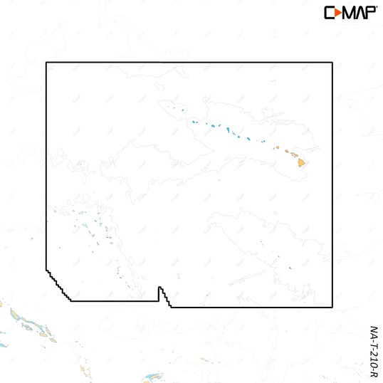
4. What areas are covered by this microSD?
The C-MAP Reveal X Coastal Hawaii, Marshall Islands and French Polynesia microSD provides extensive coverage of these three regions, including their numerous islands, atolls, and surrounding waters. The Hawaii section includes all major islands and key fishing grounds, while the Marshall Islands coverage spans remote atolls and navigational routes essential for local and visiting mariners. French Polynesia’s coverage encompasses its vast archipelagos, including Tahiti, Bora Bora, and the Marquesas Islands. This comprehensive coverage ensures that boaters have reliable navigation support, whether traveling through busy shipping lanes or exploring isolated reefs and lagoons.
5. How durable is the C-MAP Reveal X microSD and what is its expected lifespan?
The durability of the C-MAP Reveal X microSD is excellent when handled properly. Built to withstand regular use, the card is resistant to wear but should still be protected from physical damage, extreme temperatures, and moisture. When stored in its protective case and handled with care, the card can last for many years. Additionally, the data on the card remains usable as long as it is not corrupted. Regular updates and careful handling extend its lifespan. For maximum longevity, avoid bending the card, exposing it to direct sunlight for prolonged periods, or placing it in environments with high humidity.
Conclusion
The C-MAP Reveal X Coastal Hawaii, Marshall Islands and French Polynesia microSD is an essential navigation tool for anyone exploring these stunning Pacific regions. Its advanced features, extensive coverage, and user-friendly design make it an invaluable asset for safe and enjoyable boating. Whether you are a seasoned mariner or a recreational boater, this product delivers the reliability and precision you need to navigate confidently.
Special Offer
WELCOME5 – Get 5% off storewide at allboatsupplies.com
🚀 Instant Assistance: Need help selecting the right product? Drop your contact in the chatbox at the bottom right corner, and our expert team will reply within 30 minutes with the best product suggestion for your boat — including a ready-to-use checkout link. We’re fast, knowledgeable, and always here for your boating needs!
No more guesswork — just message us and get a personalized checkout link fast!
Let us handle the hassle — expert support, quick replies, and smooth checkout. Your boat deserves the best.
🔥 Up to 5% OFF – Limited Time!
Use code WELCOME5 on C-MAP Reveal X Coastal Hawaii, Marshall Islands and French Polynesia microSD
🚀 Buy Now – C-MAP Reveal X Coastal Hawaii, Marshall Islands and French Polynesia microSD
Visit Yamaha Outboards for more marine innovations
Read More
For more helpful marine maintenance guides, check out our article on Blue Sea ML-RBS Switch – Reliable 24vDC 500A Remote Battery Control.