C-MAP Reveal X South East | Best & Worst Uses Explained
C-MAP Reveal X Inland US Lakes South East microSD for Boats & Marine Engines
Introduction
Boaters navigating the beautiful but intricate waters of the Southeastern United States need precision, clarity, and confidence. That’s exactly what the C-MAP Reveal X Inland US Lakes South East microSD for Boats & Marine Engines delivers. Whether you’re a weekend angler or a seasoned cruiser, having an advanced marine cartography tool is essential for safe and efficient boating. This powerful tool provides vibrant shaded relief, high-resolution bathymetry, and customizable mapping to help you master lakes, rivers, and more across the South East region. This article dives deep into everything you need to know — features, usage, expert tips, FAQs, and even an exclusive discount.
Overview / What Is C-MAP Reveal X South East
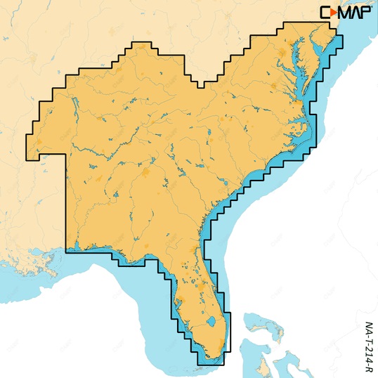
The C-MAP Reveal X Inland US Lakes South East microSD is an advanced digital marine chart compatible with most Simrad, B&G, and Lowrance chartplotters. This plug-and-play microSD card provides incredible detail and clarity for inland lake navigation across Southeastern states like Georgia, Florida, Alabama, South Carolina, and beyond. With cutting-edge bathymetric detail and unique 3D shaded relief imagery, it’s like having a high-definition GPS for your boat — but better.
Designed for inland marine navigation, it combines the precision of modern cartography with enhanced visual representation. The high-contrast colors and seamless coverage make it ideal for finding hidden structures, safe anchorages, and perfect fishing spots.
Key Features of C-MAP Reveal X South East microSD
- High-Resolution Bathymetry: Pinpoint depth changes, channels, and submerged features.
- Shaded Relief Mapping: Enjoy a stunning 3D-like experience for terrain and underwater topography.
- Custom Depth Shading: Highlight specific depth ranges for fishing or navigation.
- Satellite Overlay: Real-world imagery for precise anchoring and dock approach.
- Compatibility: Works with all Simrad, Lowrance, and B&G plotters supporting C-MAP Reveal X.
Why Choose This Chart for Southeastern Inland Lakes
Inland boating in the South East isn’t without challenges. With hundreds of lakes like Lake Lanier, Lake Okeechobee, Lake Guntersville, and others, proper navigation is key. The C-MAP Reveal X South East provides accurate guidance for both small and expansive lakes, helping you avoid hazards and discover new hotspots.
The coverage also includes rich fishing content with Fish ID, submerged structure, and weedlines, which are especially valuable for bass and crappie anglers. This means your electronics are no longer just tools—they’re tactical advantages.
Best Practices: How to Use C-MAP Reveal X South East microSD
Getting started is as easy as inserting the microSD card into your compatible device. Once inserted, your chartplotter will automatically detect the new data. Here’s how to maximize it:
- Use Custom Shading: Set target depth ranges when scouting for fish habitats.
- Switch Views: Alternate between traditional charts and shaded relief to visualize terrain better.
- Save Waypoints: Use the GPS integration to mark hot fishing spots and safe routes.
Note: Ensure your software is updated to the latest firmware for compatibility.
Maintenance Tips
Although the C-MAP Reveal X microSD card is rugged and built for marine use, proper care ensures long life and reliability. Follow these maintenance guidelines:
- Dry Handling: Always insert and remove the card with dry hands.
- Safe Storage: Store the microSD in a waterproof case when not in use.
- Avoid Frequent Removal: Keeping it inserted minimizes wear and tear on contacts.
- Update Charts: Register with C-MAP to receive chart updates for better accuracy.
Custom Depth Shading: A Game Changer for Fishermen
Anglers particularly love the customizable depth shading that comes with the C-MAP Reveal X South East microSD. This feature allows you to assign color codes to depth ranges, enabling quick visual identification of drop-offs, shallow banks, and ledges. No more wasting time in unproductive areas.
For example, if you’re targeting bass in 5-15 ft water, you can shade that depth in green. Instantly, all similar zones across the lake stand out — saving you hours and fuel. This is one of the best fish-finding tools you can own, especially when paired with sonar overlays.
Satellite Overlay and Shaded Relief Benefits
One of the standout features of this product is the satellite imagery and shaded relief combined in one seamless view. This dual imagery helps with near-shore anchoring, approaching docks, and avoiding shallow areas.
The high-resolution images offer an unparalleled perspective that printed maps or traditional charts can’t. Whether navigating tight rivers or wide-open lakes, you’ll appreciate the clarity and detail only this Reveal X card provides.
Expert Advice and Pro Recommendations
Experts recommend combining the C-MAP Reveal X Inland US Lakes South East microSD with high-performance sonar and autopilot systems. It pairs exceptionally well with Lowrance HDS Live and Simrad NSS Evo3S displays.
If you’re running Yamaha outboards, check out integration tools at Yamaha Outboards for the smoothest chartplotter connection and engine data overlay. The better your system, the more value you’ll extract from this powerful microSD chart.
Buy now and unlock full capabilities with C-MAP Reveal X Inland US Lakes South East microSD. Use code WELCOME5 at checkout for 5% off!
Detailed FAQ Section
Is the C-MAP Reveal X South East microSD compatible with my device?
Yes, the microSD card is compatible with most modern Simrad, B&G, and Lowrance units that support the Reveal X format. Some legacy devices may not fully support shaded relief or satellite overlays. Always check your user manual or contact support to ensure compatibility. For best performance, keep your firmware updated and ensure that you’re using a chartplotter that supports custom shading and high-resolution mapping.
How do I install the C-MAP Reveal X South East chart?
Installation is simple. Turn off your device, insert the microSD card into the slot, and turn the device back on. Your chartplotter should automatically detect and load the C-MAP Reveal X South East content. You can then go into the chart menu settings and select Reveal X layers, activate shading, or switch between views. If it doesn’t auto-load, ensure the device software is up to date. A quick restart usually resolves any detection issues.
Can I use the C-MAP Reveal X for fishing?
Absolutely. In fact, this card was made with anglers in mind. The detailed bathymetry, fish habitat data, and customizable shading features allow anglers to quickly identify high-probability zones for catching fish. Whether you’re fishing submerged ledges, brush piles, or deep channels, the Reveal X will give you a strategic edge. Many professional anglers consider it a vital tool for both scouting and real-time decisions.
What states are covered under the South East C-MAP Reveal X card?
This card includes lake and inland coverage for states like Georgia, Florida, Alabama, South Carolina, North Carolina, Tennessee, Mississippi, and parts of Virginia. The detail varies by lake, but major inland bodies like Lake Hartwell, Lake Lanier, and Lake Okeechobee are mapped with full Reveal X features like shaded relief and depth layering. Always verify specific coverage through the product link or contact the seller directly.
How often should I update my C-MAP Reveal X card?
It’s good practice to check for updates at least once every 6-12 months. C-MAP occasionally releases updates that improve data accuracy, adjust depth contours, or add new mapping layers. To access updates, register your product on the C-MAP website and use their software to check for and install updates. Keeping your card updated ensures safer navigation and better fish-finding capabilities.
Conclusion
The C-MAP Reveal X Inland US Lakes South East microSD for Boats & Marine Engines is an essential tool for inland lake navigation in the southeastern U.S. With unmatched chart detail, stunning visual overlays, and advanced depth shading, it’s designed to give boaters and anglers the edge they need. Whether you’re cruising new waterways or chasing trophy bass, this product is your ultimate co-pilot.
Special Offer
WELCOME5 – Get 5% off storewide at allboatsupplies.com
🚀 Instant Assistance: Need help selecting the right product? Drop your contact in the chatbox at the bottom right corner, and our expert team will reply within 30 minutes with the best product suggestion for your boat — including a ready-to-use checkout link. We’re fast, knowledgeable, and always here for your boating needs!
No more guesswork — just message us and get a personalized checkout link fast!
Let us handle the hassle — expert support, quick replies, and smooth checkout. Your boat deserves the best.
🔥 Up to 5% OFF – Limited Time!
Use code WELCOME5 on C-MAP Reveal X Inland US Lakes South East microSD
🚀 Buy Now – C-MAP Reveal X Inland US Lakes South East microSD
Read More
For more helpful marine maintenance guides, check out our article on C-MAP Reveal X Lakes North West microSD – Best & Worst Reviews.