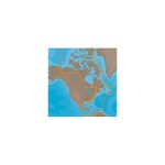
C-MAP M-NA-D033 4D microSD Atlantic Coast, Gulf of Mexico Caribbean
$207.57 Original price was: $207.57.$187.00Current price is: $187.00.
C-MAP M-NA-D039 4D microSD US Rivers OH, TN-Tom, Cumberland
$229.77 Original price was: $229.77.$207.00Current price is: $207.00.
Fast delivery within 72 Hours
C-MAP M-NA-D038 4D microSD US Rivers MS, Red, AR Ouachita, IL, MO
$229.77 Original price was: $229.77.$207.00Current price is: $207.00.
1 in stock
SKU:
WT-CMAMNAD038MS
Category: C-MAP-4D CHARTS
Brands:
C-Map
“C-MAP M-NA-D038 MicroSD MS offers advanced 4D charting features for outboard lower unit navigation, including full-feature vector charts, dynamic raster charts, and high-resolution satellite imagery for US Rivers MS, Red, AR Ouachita, IL, MO.”
Description
C-MAP M-NA-D038 4D microSD
US Rivers MS, Red, AR Ouachita, IL, MO
Model: M-NA-D038-MS
- Full-Feature Vector Charts: Toggle different views on and off to see animated tidal streams, currents and flows on your map. When planning your trip, check out the tidal heights so you won’t be caught off-guard by sudden changes. Dynamic navigational aids give you the tools you need to plan and master your route.
- Dynamic Raster – Traditional "paper chart" look with unique ability to access information on buoys, lights and other details. (Exclusive to 4D Max+)
- 3D View – Stunning three-dimensional views of land elevation and bottom contours bring the world around (and under) your boat to life. (Exclusive to 4D Max+)
- Satellite – High-resolution satellite imagery provides real-world reference, enhances situational awareness for coastal navigation. (Exclusive to 4D Max+)
- High Resolution Bathy Data – The highest available detail of underwater pinnacles, ledges and canyons that are magnets for offshore and coastal gamefish.
- Sport Fishing Data – Provides angling intelligence for wrecks and reefs, Fish ID photos, fishing tips, updated regulations, state records and more.
- Easy Routing – Automatically plots the shortest, safest route based on detailed chart data and user vessel information.
- Tides and Currents – interactive on-screen tide graphs and current arrow.
- Aerial Photos – Aerial pictures of harbor entrances, channels, and marinas.
- Guardian Alarms – Search and receive alerts for rocks, obstructions, shallows depths and other navigation hazards.
- Multi-Language Charts – More than 140 languages can be displayed using native character sets.
C-MAP 4D MAX+ is the latest evolution of electronic charting technology, combining award-winning vector chart data with exclusive Dynamic Raster Charts and the ability to view charts in 2D or amazing 3D presentation with high-resolution satellite imagery. Packed with innovative features designed to enhance every cruising, fishing or sailing experience
Compatible with top chart plotter manufacturers including, Furuno, Humminbird, Raymarine and Standard Horizon
Local and Wide coverage available worldwide, and at a budget that suits your boating needs
Ability to add future Value Added Data segments and features
C-MAP 4D MAX is also available with lower cost and content options designed specifically for the Raymarine Dragonfly Displays.
Additional information
| Weight | 0.176 lbs |
|---|---|
| Google Part Number |
M-NA-D038-MS |
| Google Product Category |
3391 |
Related Products
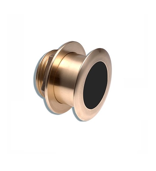
Airmar B164 1KW Bronze TH 0 Deg Tilt 8 Pin Garmin
SKU:
WT-AIRB16408G
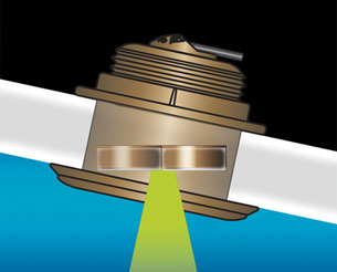
Airmar B164 1KW Bronze TH 20 Deg Tilt 8 Pin Garmin
SKU:
WT-AIRB164208G
Airmar B164 1KW Bronze TH 20D Tilted Element 10P Furuno
SKU:
WT-AIRB1642010F
Airmar B164 1KW Bronze TH 20D Tilted Element Lowrance
SKU:
WT-AIRB16420BL
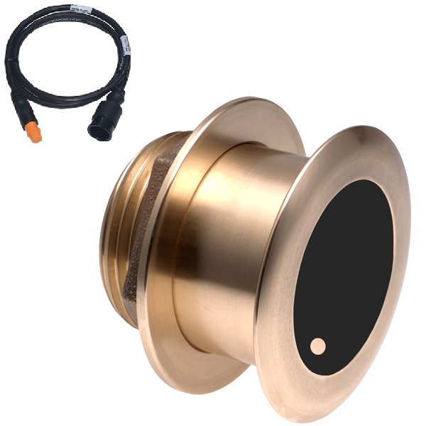
Airmar B175C-0-H 0d Tilt With Garmin 12-Pin MM Cable
SKU:
WT-AIRB175C0H12G
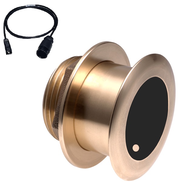
Airmar B175C-0-H 0d Tilt With Humminbird 7-Pin MM Cabl
SKU:
WT-AIRB175C0HHB
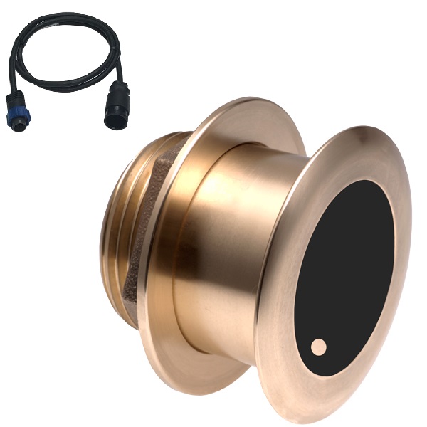
Airmar B175C-0-H 0d Tilt With Navico 7-Pin MM Cable
SKU:
WT-AIRB175C0HBL
Airmar B175C-0-H 0d Tilt With Navico 9-Pin MM Cable
SKU:
WT-AIRB175C0H9N
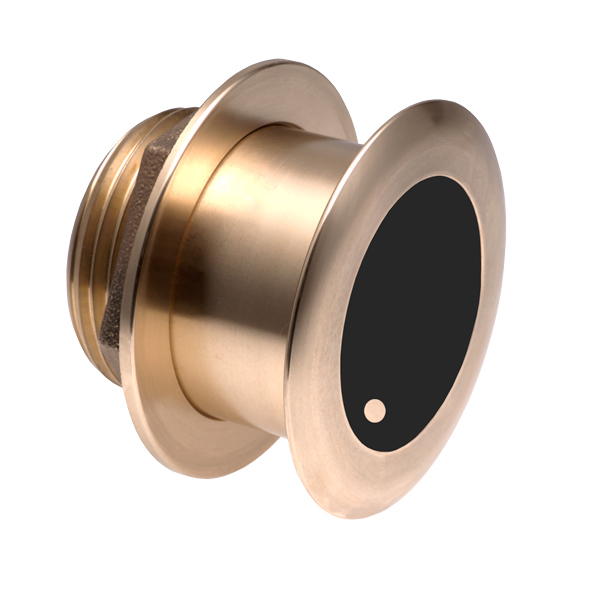
Airmar B175C-0-M 0d Tilt With No Connector MM Cable
SKU:
WT-AIRB175C0M0


