C-MAP M-NA-D039 4D microSD US Rivers OH, TN-Tom, Cumberland
$229.77 Original price was: $229.77.$207.00Current price is: $207.00.
C-MAP M-NA-D061 4D microSD Great Lakes & St Lawrence Seaway
$391.83 Original price was: $391.83.$353.00Current price is: $353.00.
Fast delivery within 72 Hours
C-MAP M-NA-D048 4D microSD Canada lakes
$109.89 Original price was: $109.89.$99.00Current price is: $99.00.
1 in stock
SKU:
WT-CMAMNAD048MS
Category: C-MAP-4D CHARTS
Brands:
C-Map
“C-MAP M-NA-D048-MS 4D microSD Canada Lakes navigation charts provide detailed lake maps, harbor charts, and tide tools for outboard lower unit navigation. Get full-feature vector charts, high-definition aerial photography, and one year of updates for confident navigation.”
Description
C-MAP M-NA-D048 4D microSD
Canada lakes
Model: M-NA-D048-MS
- Full-Feature Vector Charts: Toggle different views on and off to see animated tidal streams, currents and flows on your map. When planning your trip, check out the tidal heights so you won’t be caught off-guard by sudden changes. Dynamic navigational aids give you the tools you need to plan and master your route.
- A New Perspective: Depths and land elevation, photos, diagrams and bird’s eye view perspective options let you choose your view.
- More than Maps: View coastal roads and Points of Interest such as restaurants, museums, local services and cultural highlights.
- C-Marina Port Database: Get detailed marina port plans and harbor charts so docking is a breeze even on your first visit!
- Guardian Alarm: Keep safety in mind, but rest easy with Guardian Alarm settings that will let you know about rocks, obstructions, shallow depths and other navigation hazards.
- One Year of Updates: Crowd sourced and directly from C-MAP trusted sources, these daily updates will give you the confidence to navigate unfamiliar waters. The first year’s on us!
- Value Added Data: Add high-resolution bathymetry charts and details about Marine Protected Area so your have all the information you need at your fingertips.
Dominate the water with C-MAP’s full vector charts, harbor and approach details, tide and current tools, and more.
Full-Feature Vector Charts give you tools like tidal streams, detailed roads, and accurate marina plans, giving you the utmost situational awareness in your covered area.
High-Definition Aerial Photography will ensure you get the best view of where you are and where you’re going even in sub-optimal conditions.
Expandability is built-in to these cards via Value Added Data Segments (sold separately) so that when you need that extra local detail, adding it to the charts you already use is hassle-free.
One Free Year of daily updates means you will have the most accurate, up-to-date information available, keeping you and your crew safe out on the water.
Coverage:
Includes coverage for 130 of the most widely recognized lakes in Canada. Most of the coverage is contained within Ontario with a handful of lakes in each of the other provinces.
Includes: Lake of the Woods; Lake Winnipeg; Lake Manitoba; Okanagan Lake; Lake Simcoe; Lake Nipissing; The Winnipeg River system; Trent-Severn Waterway; Rideau Waterway; Ottawa River; St. Lawrence River
Specifications
| Card Type |
Additional information
| Weight | 0.176 lbs |
|---|---|
| Google Part Number |
M-NA-D048-MS |
| Google Product Category |
3391 |
Related Products
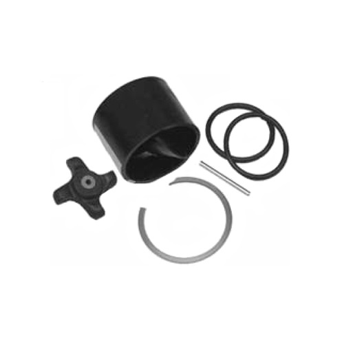
Airmar 33-493-01 Paddle Wheel Spares Kit For S800 ST800
SKU:
WT-AIR3349301
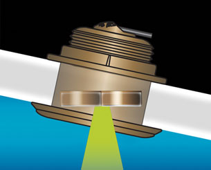
Airmar B164 1KW Bronze TH 20D Tilted Element Lowrance
SKU:
WT-AIRB16420BL
Airmar B175C-0-H 0d Tilt High CHIRP With MM Connector
SKU:
WT-AIRB175C0HMM
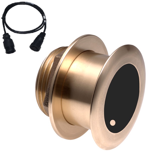
Airmar B175C-0-H 0d Tilt w/ Humminbird 14-Pin MM Cabl
SKU:
WT-AIRB175C0H14HB
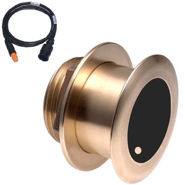
Airmar B175C-0-H 0d Tilt With Garmin 12-Pin MM Cable
SKU:
WT-AIRB175C0H12G
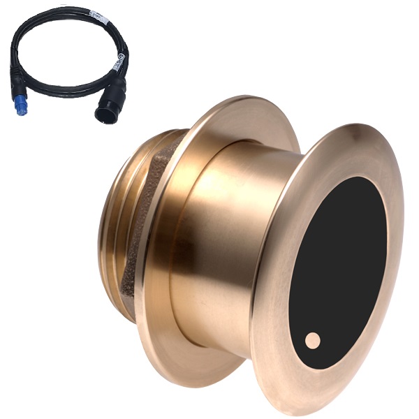
Airmar B175C-0-H 0d Tilt With Garmin 8-Pin MM Cable
SKU:
WT-AIRB175C0H8G
Airmar B175C-0-H 0d Tilt With Navico 9-Pin MM Cable
SKU:
WT-AIRB175C0H9N
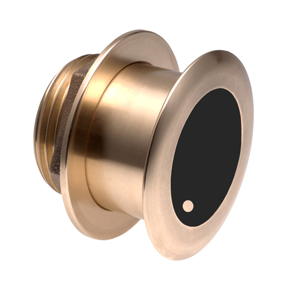
Airmar B175C-0-M 0d Tilt With No Connector MM Cable
SKU:
WT-AIRB175C0M0


