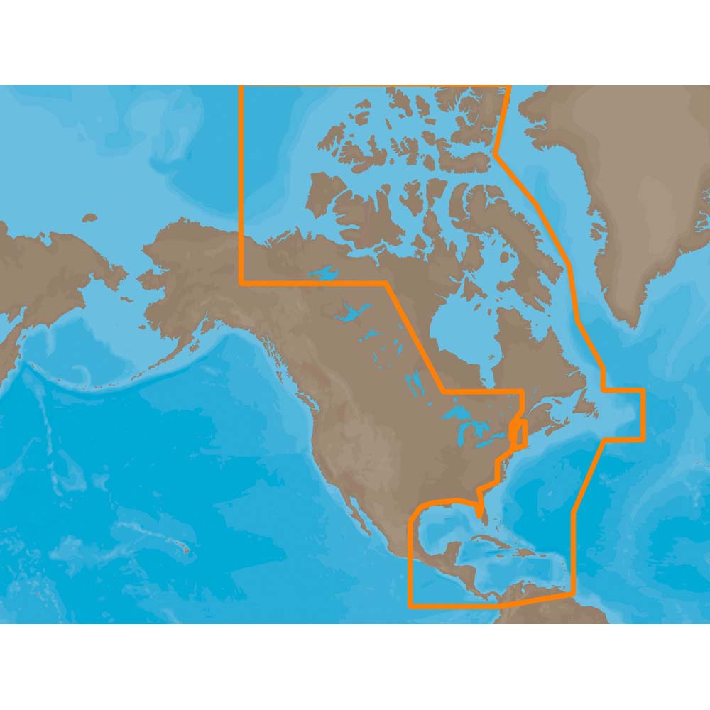
C-MAP NA-M029 Max Lakes microSD Alaska Lakes
$229.77 Original price was: $229.77.$207.00Current price is: $207.00.

C-MAP NA-M033 Max MegaWide microSD Atlantic Coast, Gulf o Mexico and Caribbean
$391.83 Original price was: $391.83.$353.00Current price is: $353.00.
Fast delivery within 72 Hours
C-MAP NA-M033 Max MegaWide C Card Atlantic Coast, Gulf of Mexico and Caribbean
$376.29 Original price was: $376.29.$339.00Current price is: $339.00.
Out of stock
SKU:
WT-CMAMNAM033CC
Category: C-MAP Max
Brands:
C-Map
Explore the C-MAP NA-M033 M-NA-M033-CC chart, compatible with top chartplotters, featuring updated coastal waters, lakes, and rivers data, perfect for outboard lower unit navigation, fishing, and sailing trips.
Description
C-MAP NA-M033 Max MegaWide
Model: M-NA-M033-CC
- Updated twice annually to provide all the latest detail and information
- Compatible with dozens of chartplotters from top manufacturers
- Extensive coverage of coastal waters, lakes and rivers
C-MAP MAX electronic charts have been a worldwide standard for years, providing cruisers, sailors and fishermen with the accurate, up-to-date chart data they need to enjoy each day on the water. Still a leading choice of navigators and chartplotter manufacturers around the globe.
Specifications
| Dynamic NavAids | Yes |
| Dynamic tides | Yes |
| Gaurdian alarm | Yes |
| Detailed marina port plans | Yes |
| Photos and diagrams | Yes |
| Route-check | Yes |
| Depths and land elevation | Yes |
| Detailed harbor | Yes |
| Perspective view | Yes |
| C-Marina Port Database | Yes |
| Points of interest | Yes |
| Multi-language capability | Yes |
Additional information
| Weight | 0.1 lbs |
|---|---|
| Google Part Number |
M-NA-M033-CC |
| Google Product Category |
3391 |
Related Products
Airmar B164 1KW Bronze TH 12D Tilted Element 10P Furuno
SKU:
WT-AIRB1641210F
Airmar B164 1KW Bronze TH 20 Deg Tilt 8 Pin Garmin
SKU:
WT-AIRB164208G
Airmar B164 1KW Bronze TH 20D Tilted Element 10P Furuno
SKU:
WT-AIRB1642010F
Airmar B164 1KW Bronze TH 20D Tilted Element Lowrance
SKU:
WT-AIRB16420BL
Airmar B175C-0-H 0d Tilt With Garmin 8-Pin MM Cable
SKU:
WT-AIRB175C0H8G
Airmar B175C-0-H 0d Tilt With Navico 7-Pin MM Cable
SKU:
WT-AIRB175C0HBL
Airmar B175C-0-H 0d Tilt With Navico 9-Pin MM Cable
SKU:
WT-AIRB175C0H9N


