C-MAP NA-M325 Max Wide microSD Gulf of Maine Bathymetric
$309.69 Original price was: $309.69.$279.00Current price is: $279.00.
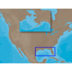
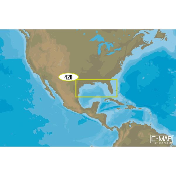
C-MAP NA-M420 Max Wide microSD Gulf of Mexico Bathymetric
$309.69 Original price was: $309.69.$279.00Current price is: $279.00.
Fast delivery within 72 Hours
C-MAP NA-M420 Max Wide C-Card Gulf of Mexico Bathymetric
$309.69 Original price was: $309.69.$279.00Current price is: $279.00.
Out of stock
SKU:
WT-CMAMNAM420CC
Category: C-MAP Max
“Experience the Gulf of Mexico like never before with the C-MAP NA-M420 Gulf of Mexico Bathymetric MicroSD Card M-NA-M420-CC. Get detailed bathymetric charts, tide and current tools, and more to navigate your outboard lower unit with confidence. (146 characters)”
Description
C-MAP NA-M420 Max Wide C-Card Gulf of Mexico Bathymetric
The C-MAP NA-M420 Max Wide C-Card Gulf of Mexico Bathymetric is a high-quality electronic chart that provides detailed and accurate mapping of the Gulf of Mexico. With its extensive coverage of marine areas, this C-Card is ideal for fishermen, sailors, and cruisers who need a reliable navigation tool. The C-MAP NA-M420 Max Wide C-Card Gulf of Mexico Bathymetric offers a range of features, including bathymetric data, fishing charts, and nautical charts, making it an essential accessory for any marine enthusiast. The C-MAP NA-M420 Max Wide C-Card Gulf of Mexico Bathymetric is compatible with a range of chart plotters and multifunction displays, ensuring seamless integration with your existing navigation system.
Why pick the C-MAP NA-M420 Max Wide C-Card Gulf of Mexico Bathymetric:
The C-MAP NA-M420 Max Wide C-Card Gulf of Mexico Bathymetric offers several unique benefits that set it apart from other electronic charts. Firstly, its bathymetric data provides a detailed representation of the seafloor, allowing you to identify hidden structures and navigate with confidence. Additionally, its fishing charts highlight areas with high fish activity, increasing your chances of a successful catch. Furthermore, the C-MAP NA-M420 Max Wide C-Card Gulf of Mexico Bathymetric is regularly updated, ensuring that you have access to the most accurate and up-to-date information.
Where to use it:
The C-MAP NA-M420 Max Wide C-Card Gulf of Mexico Bathymetric is perfect for use in the Gulf of Mexico, particularly in areas with complex marine environments. Its detailed mapping and bathymetric data make it an essential tool for fishermen, sailors, and cruisers who need to navigate through shallow waters, reefs, and other hazardous areas. The C-MAP NA-M420 Max Wide C-Card Gulf of Mexico Bathymetric is also useful for commercial vessels, such as ferries and cargo ships, that operate in the Gulf of Mexico.
Tips for maintenance:
To ensure that your C-MAP NA-M420 Max Wide C-Card Gulf of Mexico Bathymetric remains in good condition, it is essential to follow proper maintenance procedures. Firstly, regularly update your chart to ensure that you have access to the latest information. Secondly, store your C-Card in a protective case when not in use to prevent damage. Finally, avoid exposing your C-Card to water or extreme temperatures, as this can cause damage to the electronic components.
- Regularly update your chart to ensure access to the latest information.
- Store your C-Card in a protective case when not in use.
- Avoid exposing your C-Card to water or extreme temperatures.
In conclusion, the C-MAP NA-M420 Max Wide C-Card Gulf of Mexico Bathymetric is an essential accessory for any marine enthusiast operating in the Gulf of Mexico. Its detailed mapping, bathymetric data, and fishing charts make it an invaluable tool for navigation and fishing. By following proper maintenance procedures and regularly updating your chart, you can ensure that your C-MAP NA-M420 Max Wide C-Card Gulf of Mexico Bathymetric remains a reliable and accurate navigation tool for years to come.
Additional information
| Weight | 0.176 lbs |
|---|
Related Products
Airmar B164 1KW Bronze TH 0 Deg Tilt 8 Pin Garmin
SKU:
WT-AIRB16408G
Airmar B175C-0-H 0d Tilt High CHIRP With MM Connector
SKU:
WT-AIRB175C0HMM
Airmar B175C-0-H 0d Tilt w/ Humminbird 14-Pin MM Cabl
SKU:
WT-AIRB175C0H14HB
Airmar B175C-0-H 0d Tilt With Humminbird 7-Pin MM Cabl
SKU:
WT-AIRB175C0HHB
Airmar B175C-0-H 0d Tilt With Navico 7-Pin MM Cable
SKU:
WT-AIRB175C0HBL
Airmar B175C-0-H 0d Tilt With Navico 9-Pin MM Cable
SKU:
WT-AIRB175C0H9N
Airmar B175C-0-H 0d Tilt With No Connector MM Cable
SKU:
WT-AIRB175C0H0
Airmar B175C-0-M 0d Tilt With No Connector MM Cable
SKU:
WT-AIRB175C0M0


