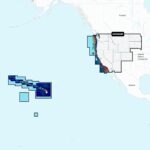
Garmin NVUS008R Navionics+ Vision+ U.S. West microSD
$277.49 Original price was: $277.49.$249.99Current price is: $249.99.
Intellisteer INTREMOTE Spare Remote Control
$71.61 Original price was: $71.61.$64.51Current price is: $64.51.
Fast delivery within 72 Hours
Garmin NSUS008R Navionics+ U.S. West microSD
$166.49 Original price was: $166.49.$149.99Current price is: $149.99.
3 in stock
SKU:
WT-GAR010C129220
Category: Garmin Navionics
Brands:
Garmin
Garmin NSUS008R Navionics+ U.S. West microSD – 010-C1292-20 provides exceptional coverage and clarity for lakes, rivers, and coasts. Get daily chart updates via ActiveCaptain app and navigate with Auto Guidance+ technology. Perfect for outboard lower unit, fishing, and navigation.
Description
Garmin NSUS008R Navionics+ U.S. West microSD
Model: 010-C1292-20
- Integrated Garmin and Navionics® content, with an updated color palette and Navionics style appearance, provides exceptional coverage, clarity and detail
- Easy access to daily chart updates is availale ActiveCaptain® app
- Built-in Auto Guidance+™ technology uses your desired depth and overhead clearance, along with chart data and frequently traveled routes, to calculate a suggested path to follow from dock to dock (Auto Guidance is for planning purposes only and does not replace safe navigation operations.)
- NOAA raster cartography is available as a free downloadable feature via the ActiveCaptain® app and can be displayed on your mobile device or compatible chartplotter
- Depth range shading lets you select up to 10 color-shaded options and view your target depths at a glance
- For improved fishing and navigation, up to 1’ contours provide a more detailed depiction of bottom structu
- To aid in navigation, the shallow water shading feature highlights depths up to a user-defined level
- ActiveCaptain® community content provides valuable POIs, recommendations and advice from boaters with firsthand experience of the local environment
- Cartography updates are available via annual renewable subscription (the first year of updates is included)
Detailed coverage of the lakes, rivers and coasts of Arizona, California, Colorado, Idaho, Montana, Nevada, North Dakota, Oregon, South Dakota, Utah, Washington, and Wyoming, Hawaii, and the Johnston and Palmyra Atolls.
Plot your paradise — with the best, most up-to-date Garmin Navionics+™ marine cartography on your compatible Garmin chartplotter. For offshore or inland waters, this all-in-one solution offers detail-rich integrated mapping of coastal features, lakes, rivers and more. It features shaded depth contours, advanced Auto Guidance+™ technology and access to daily updates via the ActiveCaptain® app for the freshest chart data every time out. Combining the best features of Garmin and Navionics® automatic routing solutions, Auto Guidance+ gives you a suggested dock-to-dock path to follow through channels, inlets, marina entrances and more. (Auto Guidance is for planning purposes only and does not replace safe navigation operations.) Multiple shading options aid in shallow water navigation and make it easy to select depth ranges for the best fishing spots. Downloadable NOAA raster imagery is also available for those who want the familiar look of paper charts.
Additional information
| Weight | 0.13 lbs |
|---|---|
| Google Part Number |
010-C1292-20 |
| Google Product Category |
3391 |
Related Products
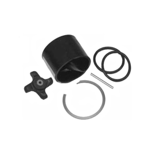
Airmar 33-493-01 Paddle Wheel Spares Kit For S800 ST800
SKU:
WT-AIR3349301
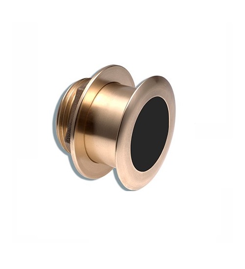
Airmar B164 1KW Bronze TH 0 Deg Tilt 8 Pin Garmin
SKU:
WT-AIRB16408G
Airmar B164 1KW Bronze TH 20D Tilted Element Lowrance
SKU:
WT-AIRB16420BL
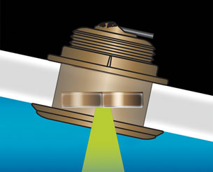
Airmar B164 1KW Bronze TH 20D Tilted Element Raymarine
SKU:
WT-AIRB16420RAY
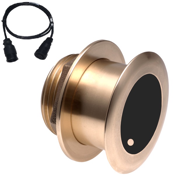
Airmar B175C-0-H 0d Tilt w/ Humminbird 14-Pin MM Cabl
SKU:
WT-AIRB175C0H14HB
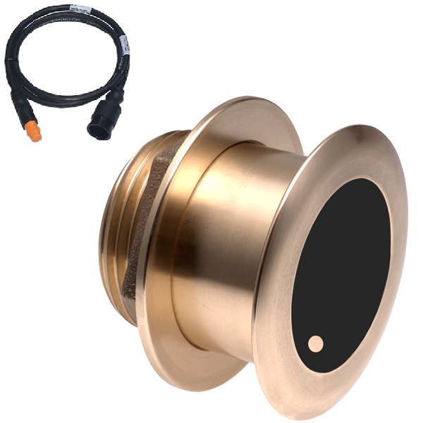
Airmar B175C-0-H 0d Tilt With Garmin 12-Pin MM Cable
SKU:
WT-AIRB175C0H12G
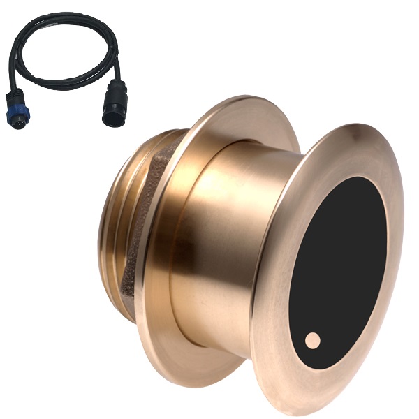
Airmar B175C-0-H 0d Tilt With Navico 7-Pin MM Cable
SKU:
WT-AIRB175C0HBL


