Garmin VUS035R G3 Vision North Slope Alaska
$388.49 Original price was: $388.49.$349.99Current price is: $349.99.
Garmin VUS511L G3 Vision Boston - Norfolk
$499.49 Original price was: $499.49.$449.99Current price is: $449.99.
Fast delivery within 72 Hours
Garmin VUS510L G3 Vision St. John – Cape Cod
$499.49 Original price was: $499.49.$449.99Current price is: $449.99.
2 in stock
SKU:
WT-GAR010C073900
Category: Garmin Vision
Brands:
Garmin
Experience unparalleled coverage with the Garmin VUS510L G3 Vision St. John – Cape Cod 010-C0739-00 chartplotter, featuring industry-leading coastal charts, Auto Guidance technology, and high-resolution relief shading for improved outboard lower unit navigation.
Description
Garmin VUS510L Vision G3 St. John – Cape Cod
Model: 010-C0739-00
- Provides industry-leading coverage, clarity and detail with updated coastal charts that feature integrated Garmin and Navionics® data
- Auto Guidance technology uses your desired depth and overhead clearance to calculate routes and show a suggested path to follow
- High-resolution relief shading combines color and shadow to give you an easy-to-interpret, clearer view of bottom structure than contour lines alone
- Depth Range Shading provides up to 10 depth ranges, enabling you to view your target depth at a glance
- Up to 1’ contours provide a more accurate depiction of the bottom structure for improved fishing charts and navigation in swamps, canals and marinas
Experience unparalleled coverage and brilliant detail on the water. BlueChart g3 Vision coastal charts provide industry-leading coverage, clarity and detail with integrated Garmin and Navionics data, Auto Guidance technology and high-resolution relief shading.
The Auto Guidance feature uses your desired depth and overhead clearance to calculate a route and a suggested path to follow.
High-resolution relief shading combines color and shadow to give you an easy-to-interpret, clearer view of bottom structure than contour lines alone.
The closer the contour lines, the more accurate the depiction of the bottom structure for improved fishing charts and navigation in swamps, canals and marinas.
If you prefer your display to have the look of paper charts, NOAA raster cartography2 is available as a free downloadable feature via the ActiveCaptain® app.
This feature provides up to 10 depth ranges, enabling you to view your target depth at a glance.
This feature allows you to use shading to designate the shallow water depths you need to avoid.
These detailed images of ports, marinas, bridges and navigational landmarks help provide you with superior situational awareness.
MarinerEye and FishEye views provide additional perspective both above and below the water line.
Note: The areas outlined in color depict the approximate coverage areas of the relief shading data included in the Vision card.
Detailed coverage the east coast of the U.S. and Canada from Cape Cod to St. John, NB, including Boston, MA, Portsmouth, NH, and Portland, ME, as well as the Kennebec R. to Augusta, ME and the Penobscot R. to Bangor, ME. Coverage also includes Martha’s Vineyard, Nantucket Island, Grand Manan Island, Mt. Desert Island, and Calais, ME as well as St. Mary’s Bay and Yarmouth, NS. Bathymetric coverage includes George’s Basin, Franklin Basin, and the Northeast Channel.
Specifications
| BlueChart g3 Vision | |
| Integrated Garmin and Navionics content | Yes |
| Auto Guidance technology | Yes |
| Depth range shading | Yes |
| Up to 1′ contours | Yes |
| Shallow water shading | Yes |
| Raster cartography | Yes |
| High-resolution relief shading | Yes |
| Unique 3-D views | Yes |
| High-resolution relief imagery | Yes |
| Aerial photos | Yes |
| BlueChart g3 | |
| Integrated Garmin and Navionics content | Yes |
| Auto Guidance technology | Yes |
| Depth range shading | Yes |
| Up to 1′ contours | Yes |
| Shallow water shading | Yes |
| Raster cartography | Yes |
Additional information
| Weight | 1 lbs |
|---|---|
| Google Part Number |
010-C0739-00 |
| Google Product Category |
3391 |
Related Products
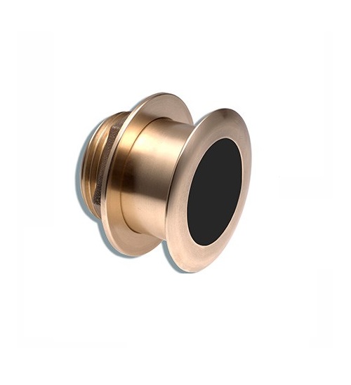
Airmar B164 1KW Bronze TH 0 Deg Tilt 8 Pin Garmin
SKU:
WT-AIRB16408G
Airmar B164 1KW Bronze TH 20D Tilted Element 10P Furuno
SKU:
WT-AIRB1642010F
Airmar B164 1KW Bronze TH 20D Tilted Element Raymarine
SKU:
WT-AIRB16420RAY
Airmar B175C-0-H 0d Tilt High CHIRP With MM Connector
SKU:
WT-AIRB175C0HMM
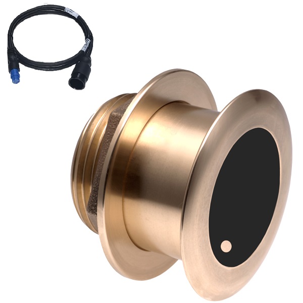
Airmar B175C-0-H 0d Tilt With Garmin 8-Pin MM Cable
SKU:
WT-AIRB175C0H8G
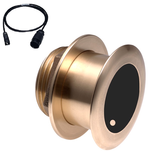
Airmar B175C-0-H 0d Tilt With Humminbird 7-Pin MM Cabl
SKU:
WT-AIRB175C0HHB
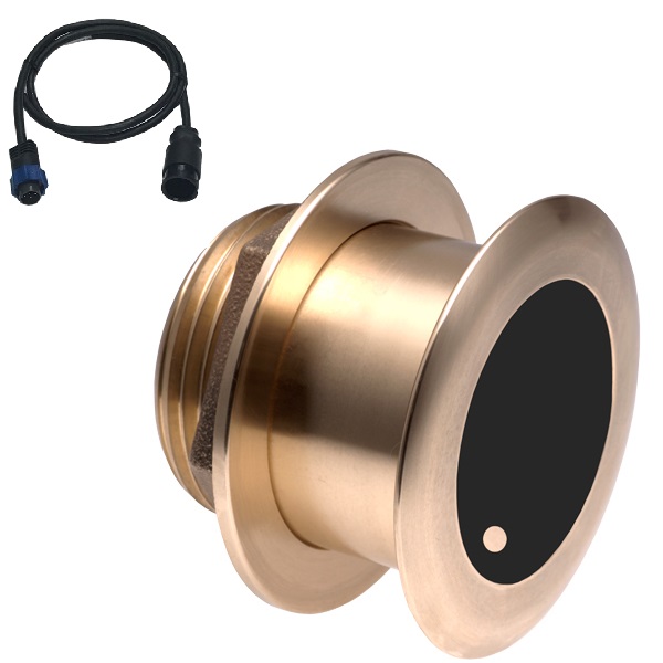
Airmar B175C-0-H 0d Tilt With Navico 7-Pin MM Cable
SKU:
WT-AIRB175C0HBL
Airmar B175C-0-H 0d Tilt With Navico 9-Pin MM Cable
SKU:
WT-AIRB175C0H9N
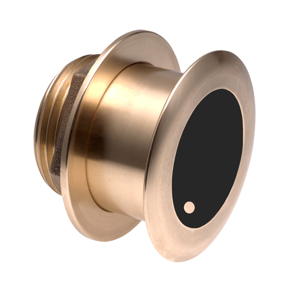
Airmar B175C-0-M 0d Tilt With No Connector MM Cable
SKU:
WT-AIRB175C0M0


